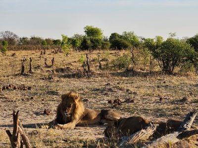
Hwange National Park, National park in western Zimbabwe.
Hwange National Park covers about 14,600 km² between Bulawayo and Victoria Falls, with Dete as the nearest town. Two-thirds of its surface is Kalahari sand, divided by fixed dunes and dry river valleys running southwest; the north rests on basalt of the Batoka Formation and granite of the Kamativi-Dete Inlier. Waterholes such as Ngweshla, Shakwanki and Nehimba are fed by groundwater seeps, while Nyamandlovu Pan is topped up by pumped water.
The area is said to have served as a royal hunting ground for King Mzilikazi in the 19th century. The British colonial administration declared it a wildlife reserve in 1928, and it gained national park status in 1930. It is named after a local tribal leader.
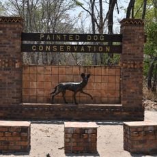
The park is named after a local tribal chief, as the German source states. Its earlier name, Wankie Game Reserve, is still recognisable in the older literature. Visitors today see the name on the entrance at Main Camp, one of three administrative camps alongside Robins and Sinamatella.
The park has several rest camps and camping areas near waterholes where you can stay overnight. The best time to visit is from June to October when conditions are more pleasant.
This place holds Zimbabwe's largest elephant population, and about 60 artificial water points help animals spread across the dry land. These water sources attract hundreds of bird species that visit daily to drink.
The community of curious travelers
AroundUs brings together thousands of curated places, local tips, and hidden gems, enriched daily by 93,849 contributors worldwide.