Enable Location

We need your location to show you interesting places around you

Discover nearby places

Find interesting locations and hidden gems around you

Precise directions

Get accurate directions and distances to places

Your location is never shared with other users. It's only used when you tap the location button.

Le Pouce

Log in to your account

Start exploring — it's free

Trusted by 61,340 travelers worldwide

Continue with Google
Continue with Apple
or

We will send you a code to connect

By continuing, you accept our Terms and Conditions and our Privacy Policy

Check your inbox

We've sent a pincode in your inbox. Please enter the code below.

Le Pouce

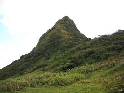
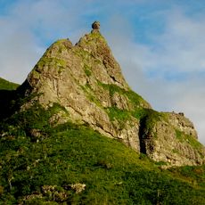
Le Pouce, Mountain summit in Port Louis District, Mauritius.

Description

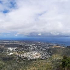
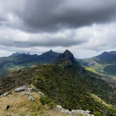
Le Pouce is a mountain summit near Port Louis with a distinctive thumb-shaped profile that stands out clearly within the central ridge of Mauritius. The peak rises to 812 meters and offers extensive views across the island's landscape from its summit.

History

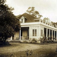
The mountain was visited by scientists and explorers in the 19th century, including Charles Darwin, who reached the summit during his 1836 visit to Mauritius. These early expeditions documented the peak as an important geographical point on the island.

Culture

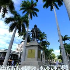
The mountain serves as a natural landmark that people recognize instantly from across the island. Its distinctive shape connects the surrounding communities and makes it a reference point in daily life for those living nearby.

Practical

Two main trails reach the summit: a shorter southern route of about 2.3 kilometers starting from Moka and a longer northern path of about 6.3 kilometers from Port Louis. The southern trail is steeper but quicker, while the northern route climbs more gradually and starts closer to the city center.

Did you know?

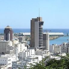
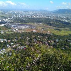
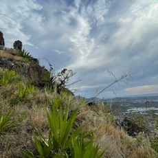
On clear days, the summit offers sight lines extending from the capital city to the northern islands, with sugar cane fields visible across the plains. This panorama reveals the agricultural heritage of the island and its geographical position in a single view.

Elevation above the sea
812 m
Address
RG3G+9WX, St Pierre, Mauritius
Opening Hours
Monday-Sunday 08:00-17:00
GPS coordinates
-20.19811,57.52882
Latest update
December 10, 2025 16:23

AroundUs brings together thousands of curated places, local tips, and hidden gems, enriched daily by 60,000 contributors worldwide. Discover all places nearby (La Laura – Malenga VCA).

« Le Pouce - Mountain summit in Port Louis District, Mauritius » is provided by Around Us (aroundus.com). Images and texts are derived from Wikimedia project under a Creative Commons license. You are allowed to copy, distribute, and modify copies of this page, under the conditions set by the license, as long as this note is clearly visible.

Discover hidden gems everywhere you go!

From secret cafés to breathtaking viewpoints, skip the crowded tourist spots and find places that match your style. Our app makes it easy with voice search, smart filtering, route optimization, and insider tips from travelers worldwide. Download now for the complete mobile experience.

Around Us App Screenshot

A unique approach to discovering new places

Le Figaro

All the places worth exploring

France Info

A tailor-made excursion in just a few clicks

20 Minutes

Around Us
Travel Guide & Maps
Download

Send to your phone

QR Code
1

Open the camera app on your mobile.

2

Point at the QR code with your camera. A notification will appear.

3

Tap the notification to open the link.