Kerguelen Arch, Collapsed natural arch on Loranchet Peninsula, Kerguelen Islands, France
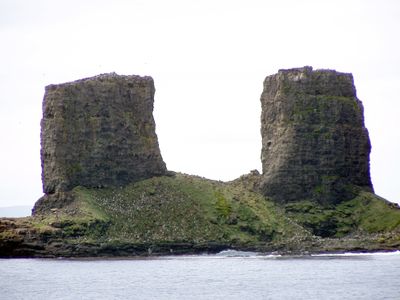
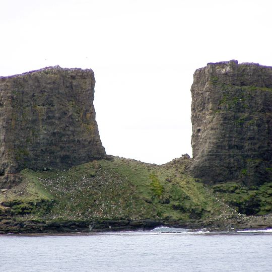
Two freestanding stone pillars rise along the northern coast between Baie de l'Oiseau and Baie de la Dauphine on Loranchet Peninsula. The vertical rock formations consist of volcanic material and mark the remains of what was once a continuous structure.
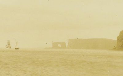
The arch was first recorded by Yves de Kerguelen in February 1773, who named the site Pointe du Portail; James Cook called it Arched-Rock in 1776. The basalt neck consisted of two pillars 103 metres high and about 80 metres apart. Its table collapsed between 1908 and 1913, but the name survived through its many depictions.
French postal authorities selected this geological feature for multiple stamp issues representing the French Southern and Antarctic Lands, establishing it as a recognized symbol of these remote subantarctic territories.
Access requires ship transportation only, as the archipelago has no civilian airport facilities. Expedition cruises departing from Réunion reach the islands after several days at sea and occasionally allow zodiac landings in calm weather conditions for viewing the formation.
The remaining pillars stand in one of the windiest regions on Earth, where average wind speeds reach 60 miles per hour (100 kilometers per hour) and oceanic forces continuously reshape the coastal landscape through constant battering.
The community of curious travelers
AroundUs brings together thousands of curated places, local tips, and hidden gems, enriched daily by 94,654 contributors worldwide.