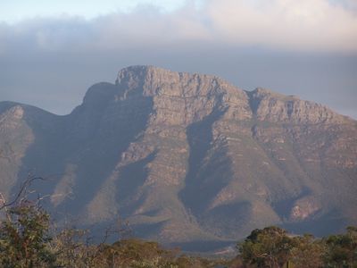
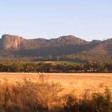
Bluff Knoll, Mountain summit in Stirling Range National Park, Australia
Bluff Knoll is a mountain summit in Stirling Range National Park reaching 1,099 meters, featuring steep rocky formations and exposed layers that reveal geological history. The landscape displays ancient rock sequences in dramatic outcrops and distinct formations shaped over time.
The mountain formed during Australia's separation from Antarctica, with sedimentary rocks dating back approximately 1.2 billion years. These rock layers accumulated from deposits left by an ancient shallow sea that once covered the region.
The local Noongar people, including the Mineng and Koreng, call it Boola Miyel, a name referring to rock formations resembling eyes watching the valley below. This name shows how the landscape has been understood and lived in by the community for countless generations.
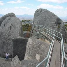
The walking trail covers about 6 kilometers and takes three to four hours, with steep and demanding sections requiring sure footing and preparation. Visitors should bring weather-resistant clothing, as conditions change quickly and strong winds are common at the top.
The summit ranks among the coldest locations in Western Australia and remains one of the few spots in the state where winter snow falls regularly. This rare weather experience makes it a special destination even during the colder months.
The community of curious travelers
AroundUs brings together thousands of curated places, local tips, and hidden gems, enriched daily by 60,000 contributors worldwide.