Enable Location

We need your location to show you interesting places around you

Discover nearby places

Find interesting locations and hidden gems around you

Precise directions

Get accurate directions and distances to places

Your location is never shared with other users. It's only used when you tap the location button.

Way Kanan

Log in to your account

Start exploring — it's free

Trusted by 62,230 travelers worldwide

Continue with Google
Continue with Apple
or

We will send you a code to connect

By continuing, you accept our Terms and Conditions and our Privacy Policy

Check your inbox

We've sent a pincode in your inbox. Please enter the code below.

Way Kanan, Administrative regency in Lampung, Indonesia.

Way Kanan is an administrative regency in Lampung province with Blambangan Umpu as its capital. The area stretches across several districts and sits at an elevation of about 80 meters.

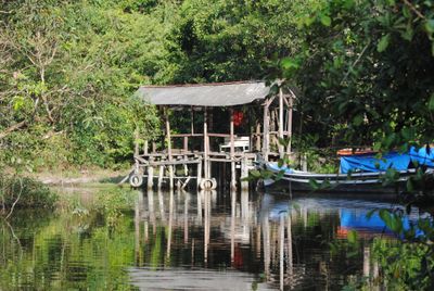
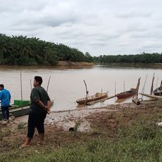
The settlement of Blambangan Umpu was founded by people originally from Tiyuh Tuha along the Way Umpu River. They relocated because regular flooding made their former home uninhabitable.

Agriculture forms the backbone of daily life here, with farming families working the land across multiple communities. The cultivation of rice, corn, coffee, and bananas shapes the landscape and local routines.

The region connects to major transportation routes and lies about 11 kilometers from the Trans-Sumatran highway. A railway line linking Palembang and Bandar Lampung also runs through the area.

The area divides into 15 different sub-districts, including Bahuga, Negeri Agung, and Rebang Tangkas. Each brings its own production patterns that contribute to the region's economic variation.

The community of curious travelers

AroundUs brings together thousands of curated places, local tips, and hidden gems, enriched daily by 60,000 contributors worldwide.

Start exploring
Location
Capital city
Blambangan Umpu
Elevation above the sea
80 m
Shares border with
West Tulang Bawang, North Lampung, West Lampung, South Ogan Komering Ulu, East Ogan Komering Ulu, Ogan Komering Ilir
GPS coordinates
-4.44705,104.52753
Latest update
December 20, 2025 14:30
« Way Kanan - Administrative regency in Lampung, Indonesia » is provided by Around Us (aroundus.com). Images and texts are derived from Wikimedia project under a Creative Commons license. You are allowed to copy, distribute, and modify copies of this page, under the conditions set by the license, as long as this note is clearly visible.

Discover hidden gems everywhere you go!

From secret cafés to breathtaking viewpoints, skip the crowded tourist spots and find places that match your style. Our app makes it easy with voice search, smart filtering, route optimization, and insider tips from travelers worldwide. Download now for the complete mobile experience.

Around Us App Screenshot

A unique approach to discovering new places

Le Figaro

All the places worth exploring

France Info

A tailor-made excursion in just a few clicks

20 Minutes

Around Us
Travel Guide & Maps
Download

Send to your phone

QR Code
1

Open the camera app on your mobile.

2

Point at the QR code with your camera. A notification will appear.

3

Tap the notification to open the link.