Enable Location

We need your location to show you interesting places around you

Discover nearby places

Find interesting locations and hidden gems around you

Precise directions

Get accurate directions and distances to places

Your location is never shared with other users. It's only used when you tap the location button.

Muara Enim

Log in to your account

Start exploring — it's free

Trusted by 62,279 travelers worldwide

Continue with Google
Continue with Apple
or

We will send you a code to connect

By continuing, you accept our Terms and Conditions and our Privacy Policy

Check your inbox

We've sent a pincode in your inbox. Please enter the code below.

Muara Enim, Administrative regency in South Sumatra, Indonesia

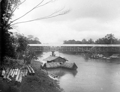
Muara Enim is a regency in South Sumatra that spans diverse terrain with multiple districts and villages spread across the area. The region includes lowlands and highland areas, with settlements ranging from rural communities to more developed centers.

The territory was established in 1959 through administrative law that reshaped the previous regional structure into its current form. This marked a significant point in how the administrative boundaries were reorganized in the area.

Different communities like the Lematang, Basemah, Malay, Minangkabau, Javanese, and Batak peoples live here and maintain their own customs and ways of life. You can see these traditions reflected in local practices, celebrations, and how people interact with each other.

The area has several hospitals, medical centers, and clinics available for health services to residents and visitors. It helps to learn where these facilities are located near your destination before traveling in the region.

The area contains significant coal deposits that are mined by a large mining company and play an important role in the local economy. This industry has shaped how the region has developed over many years.

The community of curious travelers

AroundUs brings together thousands of curated places, local tips, and hidden gems, enriched daily by 60,000 contributors worldwide.

Start exploring
Location
Inception
November 20, 1946
Capital city
Muara Enim
Elevation above the sea
1,805 m
Shares border with
Palembang, Ogan Ilir, Prabumulih, Ogan Komering Ulu, South Ogan Komering Ulu, Kaur, Lahat, Musi Rawas, Penukal Abab Lematang Ilir, Banyuasin
GPS coordinates
-4.23270,103.61410
Latest update
December 19, 2025 22:47
« Muara Enim - Administrative regency in South Sumatra, Indonesia » is provided by Around Us (aroundus.com). Images and texts are derived from Wikimedia project under a Creative Commons license. You are allowed to copy, distribute, and modify copies of this page, under the conditions set by the license, as long as this note is clearly visible.

Discover hidden gems everywhere you go!

From secret cafés to breathtaking viewpoints, skip the crowded tourist spots and find places that match your style. Our app makes it easy with voice search, smart filtering, route optimization, and insider tips from travelers worldwide. Download now for the complete mobile experience.

Around Us App Screenshot

A unique approach to discovering new places

Le Figaro

All the places worth exploring

France Info

A tailor-made excursion in just a few clicks

20 Minutes

Around Us
Travel Guide & Maps
Download

Send to your phone

QR Code
1

Open the camera app on your mobile.

2

Point at the QR code with your camera. A notification will appear.

3

Tap the notification to open the link.