Fakfak, Administrative region in West Papua, Indonesia
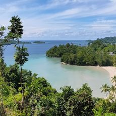
Fakfak is a regional administrative division in West Papua that spreads across coastal lowlands, inland plains, and elevated terrain organized into 17 districts. The landscape shifts from beaches and rivers to forest-covered hills and mountain ranges.
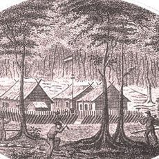
A Dutch colonial administration post was established in 1898, transforming a former port settlement into a regional center. This founding shaped how the territory is organized today.
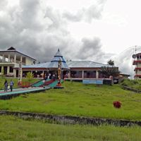
People of different faiths—Muslim, Catholic, and Protestant—live together in this region and share public spaces without conflict. You can see this coexistence reflected in how neighborhoods are organized and how residents interact in markets and gathering places.
This region can be reached by air, and once there, you can travel around using local transport and boats. The tropical climate is hot and humid year-round, so pack light clothing and protection from rain.
The region is known for large nutmeg plantations that have been cultivated for generations and remain central to the local economy. These groves shape the landscape and are still harvested by residents.
Location: West Papua
Capital city: Fakfak
Elevation above the sea: 97 m
Shares border with: Teluk Bintuni, Kaimana
GPS coordinates: -2.91670,132.30000
Latest update: December 6, 2025 22:06
Puncak Jaya
555.1 km
Fort Duurstede
411.2 km
Teluk Cenderawasih National Park
304.2 km
Red-White Bridge
463.4 km
Mount Binaiya
317.5 km
Fort of Our Lady of the Annunciation
465.7 km
Carstensz Glacier
557.4 km
Fort Belgica
321.4 km
Sumantri
556.4 km
Fort Amsterdam
474.5 km
Manusela National Park
319 km
Wapauwe Old Mosque
474.4 km
Ngga Pulu
557.5 km
Mount Manuk
366.8 km
Fort Nassau
321.6 km
Carstensz East
558 km
Mount Nila
525.9 km
Fort Du Bus
221.3 km
West Northwall Firn
556.3 km
Three Kings Cathedral
541.1 km
St. Francis Xavier Cathedral, Ambon
465.4 km
Arfak Reserve
272.3 km
Pattimura Stadium
464.1 km
Meren Glacier
557.1 km
Wollaston Glacier
557.2 km
Rumah Budaya Banda Neira
321.4 km
Fort Ceith
480.6 km
Fort Hollandia
324.3 kmReviews
Visited this place? Tap the stars to rate it and share your experience / photos with the community! Try now! You can cancel it anytime.
Discover hidden gems everywhere you go!
From secret cafés to breathtaking viewpoints, skip the crowded tourist spots and find places that match your style. Our app makes it easy with voice search, smart filtering, route optimization, and insider tips from travelers worldwide. Download now for the complete mobile experience.
A unique approach to discovering new places❞
— Le Figaro
All the places worth exploring❞
— France Info
A tailor-made excursion in just a few clicks❞
— 20 Minutes