Chest opened
+${chestReward.xp} XP
Explorer
NOUVEAU ×${chestReward.collectible.quantity}
tapez pour fermer

See the monuments around you in AR Open chests in the app

Around Us is built for your phone — point your camera at the streets and discover the monuments and places around you in augmented reality. Around Us is built for your phone — chests unlock when you walk, explore and capture nearby places.

•

Enable Location

We need your location to show you interesting places around you

Discover nearby places

Find interesting locations and hidden gems around you

Precise directions

Get accurate directions and distances to places

Your location is never shared with other users. It's only used when you tap the location button.

Mount Ainslie

Log in to your account

Start exploring — it's free

Trusted by 93,394 travelers worldwide

Continue with Google
Continue with Apple
or

We will send you a code to connect

By continuing, you accept our Terms and Conditions and our Privacy Policy

Check your inbox

We've sent a pincode in your inbox. Please enter the code below.

Mount Ainslie

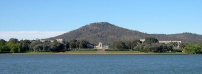
Mount Ainslie, Nature reserve summit in Canberra, Australia.

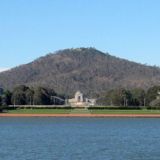
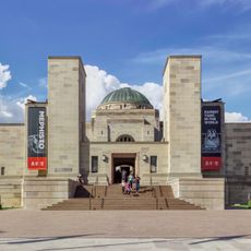
Mount Ainslie is a hill of 843 metres in Canberra Nature Park, its summit topped by a small structure and an outlook over central Canberra, Red Hill and Black Mountain. The hill is an extinct Silurian volcano, about 425 million years old, made mainly of dacite and ignimbrite. A pale stone building with a central dome stands at its base.

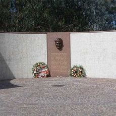
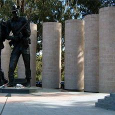
Mount Ainslie is named after James Ainslie, a 19th-century settler and overseer of the Duntroon property, not a surveyor. In 1912 Walter Burley Griffin won the international design competition for Canberra and made the hill the northernmost point of a land axis running through the Australian War Memorial and both Parliament Houses. The Kokoda summit trail, lined with plaques about the World War II campaign in Papua New Guinea, was later laid out from the back of the War Memorial.

The Ngunnawal and Ngambri peoples regard Mount Ainslie as a sacred place primarily for women's business, and with nearby Black Mountain (Galambary) they call the two hills women's breasts. The heritage Heroes Path from the Australian War Memorial to the summit is marked by plaques describing the Kokoda Track campaign of the Second World War. Weekly community events include the Mount Ainslie Run-Up and a Saturday parkrun on the bush trails along the park's western edge.

The paved Kokoda summit trail starts behind the Australian War Memorial, climbs via steps and is used by about 200 people daily. A road also reaches the summit. A quarry lies about 200 metres from the peak. The summit outlook faces central Canberra, Red Hill and Black Mountain, and is popular towards sunset.

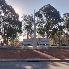
The summit beacon is a rotating air navigation light guiding traffic to Canberra Airport. The peak also marks the northern end of the land axis Walter Burley Griffin planned in 1912, running through the Australian War Memorial and both Parliament Houses. In 2013 the summit view was named after his wife, Marion Mahony Griffin.

The community of curious travelers

AroundUs brings together thousands of curated places, local tips, and hidden gems, enriched daily by 93,394 contributors worldwide.
Start exploring
Elevation above the sea
842 m
GPS coordinates
-35.26979,149.15868
Latest update
October 31, 2026 10:07
Reviews
Share your experience

No review yet

Discussions
Start a discussion...

No discussion yet

« Mount Ainslie - Nature reserve summit in Canberra, Australia » is provided by Around Us (aroundus.com). Images and texts are derived from Wikimedia project under a Creative Commons license. You are allowed to copy, distribute, and modify copies of this page, under the conditions set by the license, as long as this note is clearly visible.

Discover hidden gems everywhere you go!

From secret cafés to breathtaking viewpoints, skip the crowded tourist spots and find places that match your style. Our app makes it easy with voice search, smart filtering, route optimization, and insider tips from travelers worldwide. Download now for the complete mobile experience.

Around Us App Screenshot
❝

A unique approach to discovering new places❞

— Le Figaro

❝

All the places worth exploring❞

— France Info

❝

A tailor-made excursion in just a few clicks❞

— 20 Minutes

Around Us
Travel Guide & Maps
Download

Send to your phone

QR Code
1

Open the camera app on your mobile.

2

Point at the QR code with your camera. A notification will appear.

3

Tap the notification to open the link.