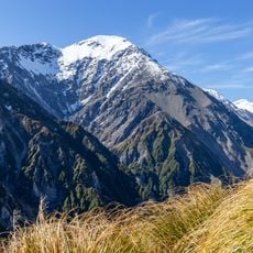
Tapuae-o-Uenuku, Mountain summit in Inland Kaikōura Range, New Zealand
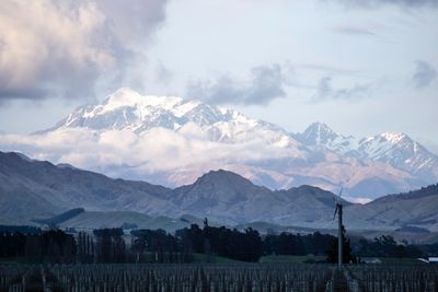
Tapuae-o-Uenuku is a mountain summit in the Inland Kaikōura Range on the northeastern South Island and reaches 2,885 meters in height. It stands as the highest peak in the region and can be seen from Cook Strait on clear days, roughly 165 kilometers away.
The summit was first spotted by James Cook in the 18th century, who initially named it Mount Odin before changing the designation later. These early European observations shaped how outsiders understood and referred to this peak for many years.
The name comes from the Māori language and means 'footprint of the rainbow', reflecting deep ties to Chief Tapuaenuku in indigenous traditions. Visitors can experience this cultural meaning through local stories and the connection the mountain holds for Māori communities.
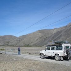
The ascent involves between 50 to 80 river crossings of the Hodder River, requiring physical stamina and careful footing along the way. Most climbers should expect to spend three days for the round trip, so planning for adequate time and preparation is important.
Edmund Hillary trained on this mountain during World War II with the Royal New Zealand Air Force before his later achievement on Mount Everest. This climbing experience helped develop the skills that would prepare him for his future mountaineering successes.
The community of curious travelers
AroundUs brings together thousands of curated places, local tips, and hidden gems, enriched daily by 60,000 contributors worldwide.