Cable Bay, Coastal settlement in Nelson region, New Zealand.
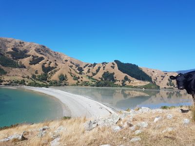
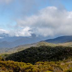
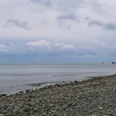
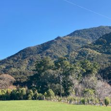
Cable Bay is a coastal settlement in the Nelson region along a northwest-facing body of water about 600 meters wide, positioned at the southern end of a land strip connecting Pepin Island to the mainland. The area features beach and water spaces surrounded by nearby hills and farmland.
The settlement gained its name from New Zealand's first overseas telegraph cable to Australia, established in 1876 and reducing communication time to Europe from six months to four days. This cable connection was a major step for the country's international links at that time.
The Māori name Rotokura refers to the red glow of sunset on the water and shows how local people connect with natural phenomena. This name remains in use today and links language with the place's distinctive character.
The Cable Bay Recreation Reserve provides parking, restrooms, and picnic areas for visitors. The location is easily accessible and allows water sports and other activities in the adjacent marine reserve.
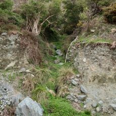
A three-hour walking trail connects this place to Glenduan across farmland with views of the Boulder Bank, though it closes during lambing season. This path links two small communities and shows the region's rural landscape.
GPS coordinates: -41.15556,173.41083
Latest update: December 6, 2025 17:41
New Zealand provides photographic subjects ranging from the Southern Alps to sand beaches on both coastlines. The landscape includes thermal springs in Rotorua, glaciers like Franz Josef and Tasman, and fjords in Fiordland. Mount Cook dominates the alpine region while the Coromandel Peninsula holds...
Amber House
15.8 km
Nelson Railway Society
15.3 km
Cawthron Atkinson Observatory
10.8 km
Boulder Bank Lighthouse
16.5 km
Botanical Reserve
16.3 km
Bryant Range
13 km
Horoirangi Marine Reserve
2.9 km
Centre of New Zealand
16 km
The Suter Te Aratoi o Whakatū
16.5 km
Pillar Letter Box
16.7 km
Magazine
16.6 km
Paremata Flats Reserve
3.2 km
State Chambers Building
16.7 km
176 Nile Street East, Nelson
16.6 km
Albion Square Historic Area
16.7 km
Queens Gardens
16.6 km
Suter Memorial Art Gallery building
16.5 km
Nelson Institute Building
16.8 km
House
16.8 km
Hardy Street Girls' School
16.7 km
Oldham Creek
11.9 km
Elma Turner Library
16.7 km
Anchor Shipping & Foundry Co Ltd Building
16.8 km
Harley House
16.2 km
Collingwood Street Bridge
16.4 km
Waterfall Creek
4.5 km
Provincial Buildings Fire Engine House
16.6 km
Trout Hatchery
16.7 kmVisited this place? Tap the stars to rate it and share your experience / photos with the community! Try now! You can cancel it anytime.
Discover hidden gems everywhere you go!
From secret cafés to breathtaking viewpoints, skip the crowded tourist spots and find places that match your style. Our app makes it easy with voice search, smart filtering, route optimization, and insider tips from travelers worldwide. Download now for the complete mobile experience.
A unique approach to discovering new places❞
— Le Figaro
All the places worth exploring❞
— France Info
A tailor-made excursion in just a few clicks❞
— 20 Minutes