Poverty Bay Club, club house in Gisborne, New Zealand
Location: Gisborne District
Address: 38 Childers Road and 53 Customhouse Street, Gisborne
GPS coordinates: -38.66886,178.02633
Latest update: December 3, 2025 00:42
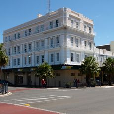
Masonic Hotel
165 m
National Bank Building (Former)
204 m
Murray Roberts & Co. Ltd (Former)
97 m
Gisborne Herald Building
211 m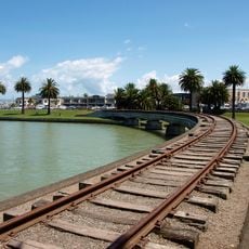
Railway Bridge
206 m
Coronation Building
159 m
Union Steamship Company Building (Former)
101 m
M. Zemba Limited Building
261 m
Public Trust Building
30 m
Acceptance House
187 m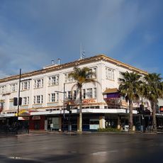
Townley Building
276 m
Lancaster House
42 m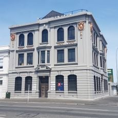
New Zealand Insurance Building
67 m
Masonic Hotel Historic Area
186 m
Gisborne Club (Former)
79 m
Eastern Co-operative Building Society (Former)
205 m
Gladstone Road Historic Area
194 m
Papa Mau Piailug
132 m
Te Korowai o Turanga FM
268 m
Nga Korowai o Te Warewhare
260 m
New Zealand Frog mural
271 m
Work of art, mural
154 m
Work of art
274 m
Work of art
154 m
Monument
155 m
Memorial, commemorative plaque
159 m
Monument
162 m
Commemorative plaque, memorial
162 mReviews
Visited this place? Tap the stars to rate it and share your experience / photos with the community! Try now! You can cancel it anytime.
Discover hidden gems everywhere you go!
From secret cafés to breathtaking viewpoints, skip the crowded tourist spots and find places that match your style. Our app makes it easy with voice search, smart filtering, route optimization, and insider tips from travelers worldwide. Download now for the complete mobile experience.

A unique approach to discovering new places❞
— Le Figaro
All the places worth exploring❞
— France Info
A tailor-made excursion in just a few clicks❞
— 20 Minutes