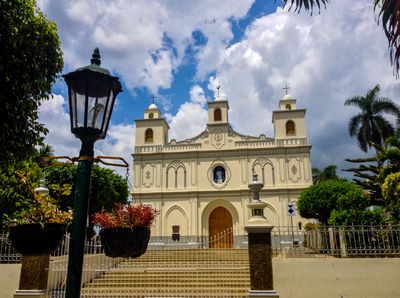
Ahuachapán, Administrative district and capital city in western El Salvador.
Ahuachapán is a city in western El Salvador situated on hilly terrain and surrounded by coffee plantations and mountain ranges. The administrative area divides into 29 cantons, linking urban spaces with rural and natural surroundings.
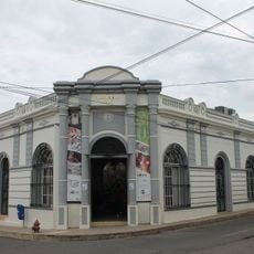
The city was founded by Poqomam Mayan tribes and gained city status in 1862, becoming the department capital in 1899. This progression reflects the region's growing importance as an administrative center.
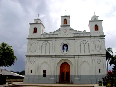
The Day of Little Lantern Lights takes place each September 7, when residents light up the streets to honor the Virgin Mary. This celebration shows how deeply faith shapes community traditions here.
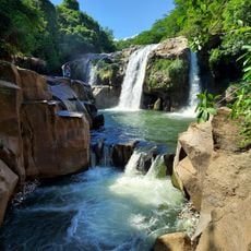
The city sits on hilly terrain, so walking around requires effort, especially during hot weather. It helps to explore at a relaxed pace and plan rest breaks, particularly when visiting higher elevation areas.
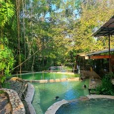
The region uses geothermal power plants that tap into underground steam vents for energy production, demonstrating how natural resources support modern technology here. Visitors can see these installations and learn about this form of renewable energy generation.
Location: Central Ahuachapán
Elevation above the sea: 800 m
GPS coordinates: 13.92342,-89.84629
Latest update: December 22, 2025 16:26
Santa Teresa Hot Springs.
3.8 km
Salto Malacatiupán
9.6 kmCerro de Apaneca
10.5 km
Centro para la Cultura y las Artes "Dr. Alfredo Espino"
309 mCerro Cachio
10.8 kmLabyrinth, 1$ 2022
5.6 kmTermales de Santa Teresa
3.8 kmXtreme tours buggy
8.4 kmLos Ausoles - geotérmica
3.1 kmRuinas de la iglesia vieja
9.5 kmPiscina
13.7 kmCima de Cerro Caballo
13.7 kmTuricentro aguijullo
11.3 kmBorder Crossing
12.3 kmMirador de la Cruz de Ataco
6.5 kmCentro Turístico Municipal Siloe
3.4 kmApaneca Canopy Tour
8.6 kmPuente viejo Agua Caliente
9.1 kmCerro Las Ninfas
6.7 kmApaneca's Maze
8.2 kmMural La Quiruba
13.4 kmMural de San Lorenzo
13.3 kmBust, Work of art
1.8 kmMirador de Apaneca
9.5 kmCrater Viewpoint
7.4 kmScenic viewpoint
8.4 kmPeña Blanca
8.4 kmDon Juan waterfall (correct location)
10.8 kmVisited this place? Tap the stars to rate it and share your experience / photos with the community! Try now! You can cancel it anytime.
Discover hidden gems everywhere you go!
From secret cafés to breathtaking viewpoints, skip the crowded tourist spots and find places that match your style. Our app makes it easy with voice search, smart filtering, route optimization, and insider tips from travelers worldwide. Download now for the complete mobile experience.
A unique approach to discovering new places❞
— Le Figaro
All the places worth exploring❞
— France Info
A tailor-made excursion in just a few clicks❞
— 20 Minutes