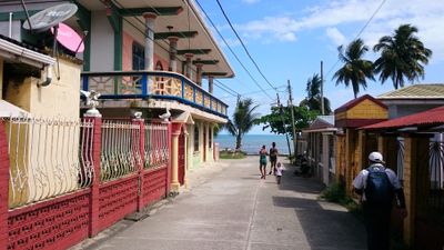
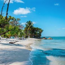
Livingston, Caribbean port town in Izabal Department, Guatemala
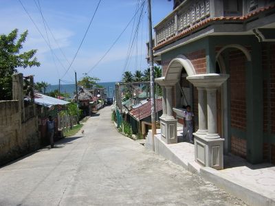
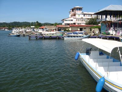
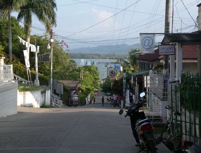
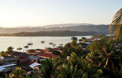
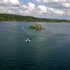
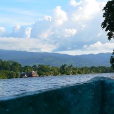
Livingston sits where the Rio Dulce meets the Caribbean Sea, spreading across hillsides with wooden buildings facing the water. The town functions as a working port surrounded by water on most sides, creating a maritime character throughout.
Marco Sánchez Díaz, a Haitian captain, founded the settlement in 1831. It became Guatemala's main Caribbean harbor before Puerto Barrios took over that role.
The people here speak Garifuna, Q'eqchi, and Spanish, and their music and cooking traditions shape daily life in visible ways. These languages and food customs make every street market and restaurant a place where different cultures meet.
Getting here means taking a boat from Rio Dulce or Puerto Barrios, with regular water services running during daylight hours. Water is the only reliable access route, so arrange your boat ride ahead of time.
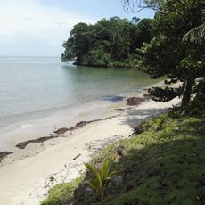
Siete Altares, a natural formation outside the main area, has seven pools filled with fresh water connected by small waterfalls. This spot offers a surprising tropical escape surrounded by thick jungle growth.
Location: Izabal Department
Inception: 1831
Elevation above the sea: 0 m
Shares border with: Chahal, El Estor, Lake Izabal
Website: http://inforpressca.com/livingston
GPS coordinates: 15.83000,-88.75000
Latest update: December 6, 2025 16:01
Guatemala offers photographers a mix of pre-Columbian sites, volcanic landscapes, and colonial buildings. The geography ranges from highland towns to rainforests and coastal areas along the Pacific and Caribbean. Ancient Maya temples stand alongside Spanish-era churches, while indigenous markets and traditional villages show cultural life. The landscape is marked by active and dormant volcanoes, often surrounded by coffee plantations. Places like Antigua Guatemala display colonial architecture with cobblestone streets and courtyards. Lake Atitlán sits between mountains and smaller communities. Tikal and other archaeological sites in the north preserve Maya structures within jungle settings. Chichicastenango Market is known for woven textiles and incense. Pacaya and Acatenango are accessible volcanoes, while Semuc Champey offers natural pools in a limestone forest. The variety of regions makes Guatemala a country with different perspectives in short distances.
Guatemala contains several photographic subjects within its borders. Maya ruins such as Tikal, Yaxha and Quiriguá stand in the tropical forests of Petén and Izabal. Colonial architecture appears in Antigua Guatemala, where the Santa Catalina Arch and painted facades line cobblestone streets. Lake Atitlán sits between three volcanoes, with towns like Santiago Atitlán and San Marcos La Laguna offering different perspectives on the water. Active volcanoes including Pacaya and Acatenango provide opportunities to photograph lava flows and crater landscapes. The highland areas of Alta Verapaz hold Semuc Champey, a natural limestone pool, and the caves of Lanquín and Candelaria. Hot springs at Fuentes Georginas lie near Quetzaltenango in the western highlands. Chichicastenango Market documents textile trade and indigenous ceremonies. Livingston on the Rio Dulce shows Garifuna culture on the Caribbean coast, while Monterrico offers black sand beaches on the Pacific. Less visited sites like Dos Pilas, Takalik Abaj and Iximche add pre-Columbian contexts. The collection covers both well known and remote locations across Guatemala's varied geography.
Quiriguá
69.7 km
Fortaleza de San Fernando
76.2 km
Castillo de San Felipe de Lara
33.8 km
Nim Li Punit
54.4 km
Cusuco National Park
61.2 km
Estadio General Francisco Morazán
84.8 km
Puente de Río Dulce
32.9 km
San Pedro Sula Cathedral barby
85.8 km
Chocón Machacas
15.9 km
Naj Tunich
75 km
Estadio Yankel Rosenthal Cuello
88.7 km
Laughing Bird Caye
90.3 km
Bladen Nature Reserve
75 km
Ixtutz
76.2 km
Xnaheb
54.4 km
Ranguana Caye
85 km
Estadio Excélsior
87 km
Maguen David Synagogue
84.6 km
USCGC Walnut
87.4 km
Bugle Caye Light
86.3 km
Parque Nacional Río Dulce
16 km
The Little Sula Children's Museum
86 km
Coto river
73.9 km
Museo
69.3 km
Rio Dulce National Park
30.5 km
Las Conchas Natural Park
76.3 km
Calvario Poptun
90.8 km
Finca El Cisne
96.3 kmReviews
Visited this place? Tap the stars to rate it and share your experience / photos with the community! Try now! You can cancel it anytime.
Discover hidden gems everywhere you go!
From secret cafés to breathtaking viewpoints, skip the crowded tourist spots and find places that match your style. Our app makes it easy with voice search, smart filtering, route optimization, and insider tips from travelers worldwide. Download now for the complete mobile experience.
A unique approach to discovering new places❞
— Le Figaro
All the places worth exploring❞
— France Info
A tailor-made excursion in just a few clicks❞
— 20 Minutes