Enable Location

We need your location to show you interesting places around you

Discover nearby places

Find interesting locations and hidden gems around you

Precise directions

Get accurate directions and distances to places

Your location is never shared with other users. It's only used when you tap the location button.

Támesis

Log in to your account

Start exploring — it's free

Trusted by 67,569 travelers worldwide

Continue with Google
Continue with Apple
or

We will send you a code to connect

By continuing, you accept our Terms and Conditions and our Privacy Policy

Check your inbox

We've sent a pincode in your inbox. Please enter the code below.

Discussion Reviews 1 Photos
24.6k Popularity

Támesis, Administrative municipality in Southwestern Antioquia, Colombia.

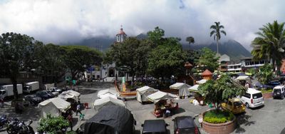
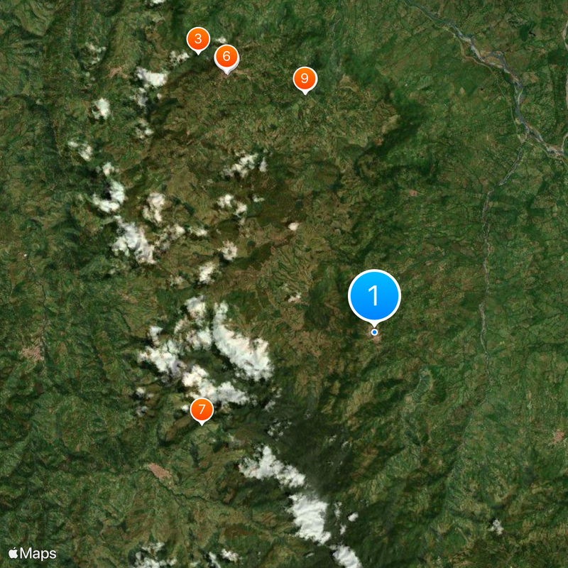
Támesis is a municipality in Southwestern Antioquia located at about 1,600 meters elevation across mountainous terrain. The area is shaped primarily by agriculture, with fields dedicated to coffee, plantains, and cacao that characterize the local landscape and daily life.

Támesis was established on December 25, 1858, by Pedro Orozco Ocampo and Rafaela Gómez Trujillo, who purchased land from previous settlers in the area. The founding followed the common pattern of the era, opening up Andean highlands for farming settlements.

The Cacao Growers' Festival is an important local celebration where producers showcase their harvest and traditional processing methods. Visitors witness how the crop shapes community identity and brings people together to share their work and traditions.

The hilly terrain makes walking tiring, so visitors should bring sturdy shoes and water while adjusting to the highland altitude. Travel is easiest during dry seasons when rural paths are most passable.

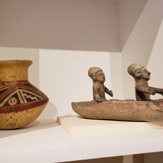
The territory contains numerous pre-Hispanic petroglyphs scattered across the landscape, revealing traces of indigenous settlement that predates the modern town. These rock carvings provide clues about how early people used these mountain lands.

The community of curious travelers

AroundUs brings together thousands of curated places, local tips, and hidden gems, enriched daily by 60,000 contributors worldwide.

Start exploring
Location
Southwestern Antioquia
Location
Inception
1858
Elevation above the sea
1,638 m
GPS coordinates
5.66472,-75.71444
Latest update
December 20, 2025 12:25
Reviews
Share your experience

No review yet

Discussions
Start a discussion...

No discussion yet

« Támesis - Administrative municipality in Southwestern Antioquia, Colombia » is provided by Around Us (aroundus.com). Images and texts are derived from Wikimedia project under a Creative Commons license. You are allowed to copy, distribute, and modify copies of this page, under the conditions set by the license, as long as this note is clearly visible.

Discover hidden gems everywhere you go!

From secret cafés to breathtaking viewpoints, skip the crowded tourist spots and find places that match your style. Our app makes it easy with voice search, smart filtering, route optimization, and insider tips from travelers worldwide. Download now for the complete mobile experience.

Around Us App Screenshot

A unique approach to discovering new places

Le Figaro

All the places worth exploring

France Info

A tailor-made excursion in just a few clicks

20 Minutes

Around Us
Travel Guide & Maps
Download

Send to your phone

QR Code
1

Open the camera app on your mobile.

2

Point at the QR code with your camera. A notification will appear.

3

Tap the notification to open the link.