Santa Rosa de Osos

Log in to your account

AroundUs is a community-driven map of interesting places, built by curious explorers like you. It grows with every review, story, and photo you share.
Connect to save your favorite spots, contribute locations, and create personalized routes.
Continue with Google
Continue with Apple
Continue with X
Continue with Facebook
Continue with email
By continuing, you accept our Terms and Conditions and our Privacy Policy
Create an account
Add to collection
Map
Suggest a change
Share

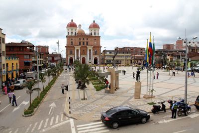
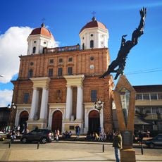
Santa Rosa de Osos, Colonial municipality in Northern Antioquia, Colombia.

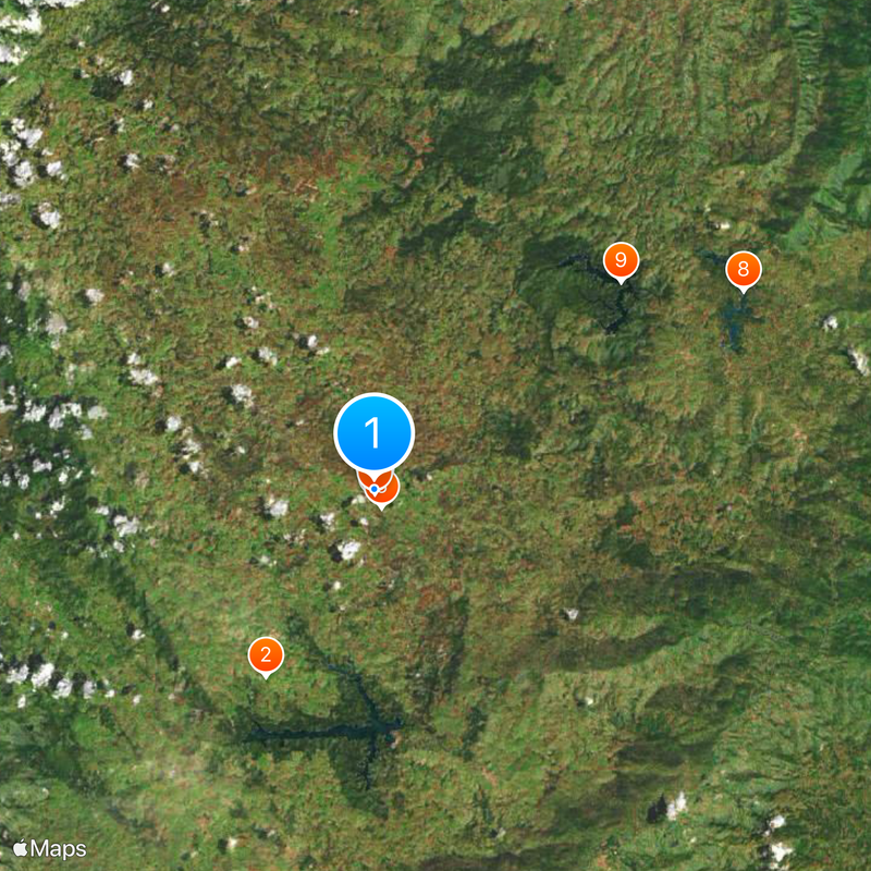
Santa Rosa de Osos is a municipality in Northern Antioquia's mountain region, located at 2,640 meters elevation and covering approximately 812 square kilometers. The terrain rises into a landscape of valleys and hills where farmland and grasslands dominate the surroundings.

The area was originally inhabited by the Nutabé indigenous people before Spanish settlers arrived in 1541. From these early encounters, a formal municipality gradually emerged and was officially established in 1814.

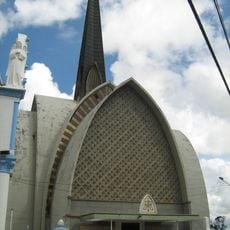
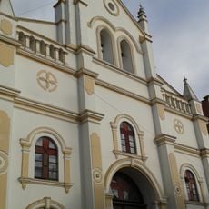
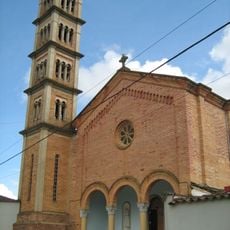
The townscape reflects a deep Catholic tradition visible in churches and religious buildings that have shaped community life since the diocese was established. This spiritual identity remains woven into daily routines and architectural choices throughout the municipality.

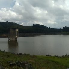
The area is agricultural in character and known for producing milk that supplies surrounding communities in the region. The municipality also manages water reservoirs, including Lakes Riogrande I and II, that provide water resources for the Aburrá Valley below.

The original name "Valley of the Bears" came from Spanish captain Francisco Vallejo, though no historical records ever documented bears actually living in the area. This naming choice created a mystery that persisted for centuries about why the territory carried such a distinctive designation.

Location: Northern Antioquia

Location: Antioquia

Inception: 1636

Elevation above the sea: 2,640 m

Website: http://santarosadeosos-antioquia.gov.co

GPS coordinates: 6.64722,-75.46056

Latest update: December 17, 2025 08:32

Photos
Reviews

Visited this place? Tap the stars to rate it and share your experience / photos with the community! Try now! You can cancel it anytime.

« Santa Rosa de Osos - Colonial municipality in Northern Antioquia, Colombia » is provided by Around Us (aroundus.com). Images and texts are derived from Wikimedia project under a Creative Commons license. You are allowed to copy, distribute, and modify copies of this page, under the conditions set by the license, as long as this note is clearly visible.

Discover hidden gems everywhere you go!

From secret cafés to breathtaking viewpoints, skip the crowded tourist spots and find places that match your style. Our app makes it easy with voice search, smart filtering, route optimization, and insider tips from travelers worldwide. Download now for the complete mobile experience.

Around Us App Screenshot

A unique approach to discovering new places

Le Figaro

All the places worth exploring

France Info

A tailor-made excursion in just a few clicks

20 Minutes