Enable Location

We need your location to show you interesting places around you

Discover nearby places

Find interesting locations and hidden gems around you

Precise directions

Get accurate directions and distances to places

Your location is never shared with other users. It's only used when you tap the location button.

Sierra Nevada de Santa Marta

Log in to your account

Join the adventure

Create your free account and start exploring (like 60k+ others)

We will send you a code to connect

or
Continue with Google
Continue with Apple
By continuing, you accept our Terms and Conditions and our Privacy Policy

Check your inbox

We've sent a pincode in your inbox. Please enter the code below.

Sierra Nevada de Santa Marta

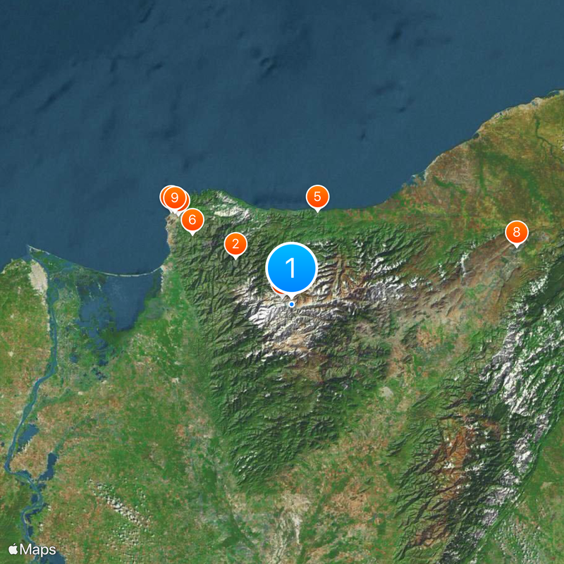
Sierra Nevada de Santa Marta, Mountain range in northern Colombia.

Description

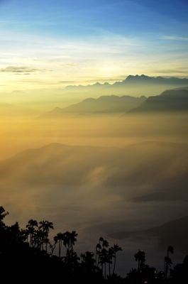
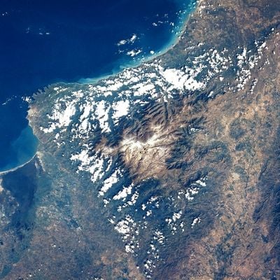
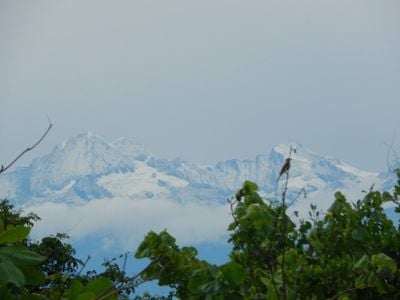
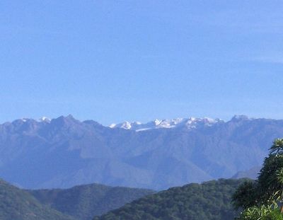
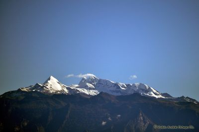
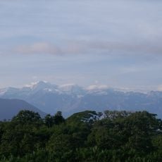
Sierra Nevada de Santa Marta is a mountain massif on the Caribbean coast of Colombia, with peaks rising nearly 5,800 meters less than 50 kilometers from the sea. The range extends across three departments and forms the tallest coastal mountain system on Earth.

History

Spanish explorers reached the range in the early 16th century and soon founded Santa Marta as the first permanent European settlement on the South American mainland. The indigenous inhabitants retreated to higher elevations to preserve their way of life and beliefs.

Culture

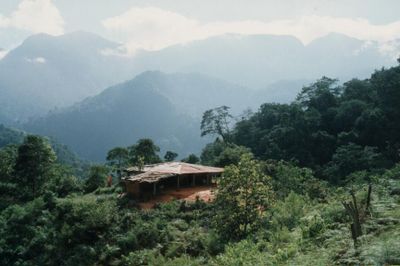
The four indigenous groups still inhabit the slopes and guard sacred sites that remain closed to outsiders. Their settlements with round huts and terraced fields show a way of life that has changed little over centuries.

Practical

Hiking trips work best during the dry season between December and March, when trails remain passable and visibility stays clear. Travelers should prepare for multiple climate zones, as temperatures range from coastal heat to freezing conditions at the highest elevations.

Did you know?

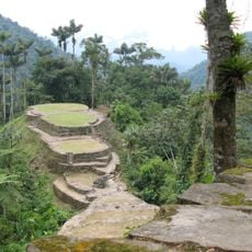
The range holds every climate zone on Earth within a small area, from tropical rainforest to glaciers that still cap the highest peaks. Archaeological sites with stone terraces and staircases from pre-Columbian times lie hidden in the forest and show evidence of an advanced civilization.

Location
Inception
1964
Elevation above the sea
5,730 m
Made from material
metamorphic rock
GPS coordinates
10.83500,-73.67500
Latest update
December 14, 2025 21:39

AroundUs brings together thousands of curated places, local tips, and hidden gems, enriched daily by 60,000 contributors worldwide. Discover all places nearby (Aracataca).

« Sierra Nevada de Santa Marta - Mountain range in northern Colombia » is provided by Around Us (aroundus.com). Images and texts are derived from Wikimedia project under a Creative Commons license. You are allowed to copy, distribute, and modify copies of this page, under the conditions set by the license, as long as this note is clearly visible.

Discover hidden gems everywhere you go!

From secret cafés to breathtaking viewpoints, skip the crowded tourist spots and find places that match your style. Our app makes it easy with voice search, smart filtering, route optimization, and insider tips from travelers worldwide. Download now for the complete mobile experience.

Around Us App Screenshot

A unique approach to discovering new places

Le Figaro

All the places worth exploring

France Info

A tailor-made excursion in just a few clicks

20 Minutes

Around Us
Travel Guide & Maps
Download

Send to your phone

QR Code
1

Open the camera app on your mobile.

2

Point at the QR code with your camera. A notification will appear.

3

Tap the notification to open the link.