Fort Inge, Military fort in Uvalde County, United States.
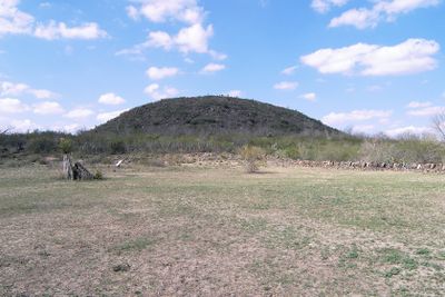
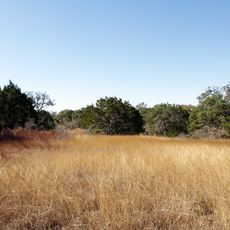
Fort Inge was a military installation on the eastern bank of the Leona River, positioned to control movement through the frontier region. The site contains remnants of structures and archaeological deposits scattered across the grounds, along with a distinctive geological formation called Mount Inge.
The installation was founded in 1849 when a military officer established it with a small garrison to secure the frontier. It was named in honor of a soldier who had died in a previous war, reflecting the hardships of frontier military service.
This site represents how military outposts functioned as protective centers during frontier expansion and settlement. Walking through the grounds helps you understand the daily operations and strategic importance of such installations in the region's development.
The site operates as a public park where visitors can walk among the remains and read informational displays about the fort's history. The riverside location provides a pleasant setting for exploration and is accessible on foot with clear paths across the grounds.
Archaeological evidence reveals that people inhabited this location for thousands of years before the military installation was built. These ancient layers give the site a deeper time dimension that extends well beyond its frontier military period.
The community of curious travelers
AroundUs brings together thousands of curated places, local tips, and hidden gems, enriched daily by 60,000 contributors worldwide.