Chest opened
+${chestReward.xp} XP
Explorer
NOUVEAU ×${chestReward.collectible.quantity}
tapez pour fermer
Chest locked

Open chests in the app

Around Us is built for your phone — chests unlock when you walk, explore and capture nearby places.

Enable Location

We need your location to show you interesting places around you

Discover nearby places

Find interesting locations and hidden gems around you

Precise directions

Get accurate directions and distances to places

Your location is never shared with other users. It's only used when you tap the location button.

Log in to your account

Start exploring — it's free

Trusted by 72,889 travelers worldwide

Continue with Google
Continue with Apple
or

We will send you a code to connect

By continuing, you accept our Terms and Conditions and our Privacy Policy

Check your inbox

We've sent a pincode in your inbox. Please enter the code below.

Bromide Formation
Discussion Reviews Photo
2.1k Popularity

Bromide Formation, Geological formation in south-central Oklahoma, United States.

The Bromide Formation is a geological sequence in south-central Oklahoma made up of alternating layers of limestone, shale, and sandstone. These deposits formed in ancient marine environments where different sediment types accumulated over time as conditions shifted.

The Bromide Formation developed around 460 million years ago during the early Sandbian period when a shallow sea covered parts of the North American continent. This marine basin left behind layers that scientists today use to understand ancient ocean conditions and the evolution of early life.

Scientists and researchers regularly visit the formation to study its extensive collection of marine fossils, including trilobites, echinoderms, and green algae specimens.

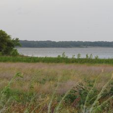
This formation surfaces in several mountainous regions like the Arbuckle Mountains and Wichita Mountains and can be reached at various locations across south-central Oklahoma. A visit typically requires access to private land or protected areas, so visitors should check access conditions in advance.

The formation holds substantial oil and gas reserves, especially in northern areas where the geological structure remains underground. This economic interest in the site has also enabled scientific drilling and exploration that revealed new knowledge about deep layers.

The community of curious travelers

AroundUs brings together thousands of curated places, local tips, and hidden gems, enriched daily by 60,000 contributors worldwide.

Start exploring
Location
GPS coordinates
34.00000,-97.00000
Latest update
March 15, 2026 14:42
Around this place
Hagerman National Wildlife Refuge
United States of America

Hagerman National Wildlife Refuge

37.3 km
United States of America

Lake Jean Neustadt

35.5 km
Black Theater of Ardmore
United States of America

Black Theater of Ardmore

22.1 km
United States of America

Rock Creek Reservoir

33 km
Ardmore Carnegie Library
United States of America

Ardmore Carnegie Library

22.7 km
United States of America

James H. Bounds Barn

22 km
Love County Courthouse
United States of America

Love County Courthouse

13.2 km
Marshall County Courthouse
United States of America

Marshall County Courthouse

23.5 km
Love County Jail and Sheriff's Residence
United States of America

Love County Jail and Sheriff's Residence

13.3 km
Marina Beach
United States of America

Marina Beach

10.1 km
United States of America

Hubert M Moss Lake

33.6 km
United States of America

Lake Murray State Park Entry Station

17.8 km
United States of America

Lake Dealey

36.9 km
United States of America

Island View Public Use Area

34.3 km
United States of America

Ardmore Club Lake

32.9 km
United States of America

Oknoname 085003 Reservoir

32.1 km
United States of America

Lake Murray State Park Tower Base

16.1 km
United States of America

Lake Murray State Park CCC Picnic Shelter at Buzzard Roost

10.3 km
United States of America

Carter Lake

23.2 km
United States of America

Graveyard Bluff

5.5 km
United States of America

White Bluff

27.9 km
United States of America

Lake Murray State Park Superintendent's Residence

17.9 km
United States of America

Mckown Lake

25.3 km
United States of America

Reeves Ravine Reservoir

34.9 km
Lake Murray State Park
United States of America

Lake Murray State Park

12.1 km
United States of America

Washington House (Sycamore Creek Ranch)

15.4 km
Sunset Beach Day Use Area
United States of America

Sunset Beach Day Use Area

10.8 km
United States of America

Kingston Auditorium

26.4 km
Show the full map
Reviews
Share your experience

No review yet

Discussions
Start a discussion...

No discussion yet

« Bromide Formation - Geological formation in south-central Oklahoma, United States » is provided by Around Us (aroundus.com). Images and texts are derived from Wikimedia project under a Creative Commons license. You are allowed to copy, distribute, and modify copies of this page, under the conditions set by the license, as long as this note is clearly visible.

Discover hidden gems everywhere you go!

From secret cafés to breathtaking viewpoints, skip the crowded tourist spots and find places that match your style. Our app makes it easy with voice search, smart filtering, route optimization, and insider tips from travelers worldwide. Download now for the complete mobile experience.

Around Us App Screenshot

A unique approach to discovering new places

Le Figaro

All the places worth exploring

France Info

A tailor-made excursion in just a few clicks

20 Minutes

Around Us
Travel Guide & Maps
Download

Send to your phone

QR Code
1

Open the camera app on your mobile.

2

Point at the QR code with your camera. A notification will appear.

3

Tap the notification to open the link.