Chest opened
+${chestReward.xp} XP
Explorer
NOUVEAU ×${chestReward.collectible.quantity}
tapez pour fermer
Chest locked

Open chests in the app

Around Us is built for your phone — chests unlock when you walk, explore and capture nearby places.

Enable Location

We need your location to show you interesting places around you

Discover nearby places

Find interesting locations and hidden gems around you

Precise directions

Get accurate directions and distances to places

Your location is never shared with other users. It's only used when you tap the location button.

Erath

Log in to your account

Start exploring — it's free

Trusted by 72,882 travelers worldwide

Continue with Google
Continue with Apple
or

We will send you a code to connect

By continuing, you accept our Terms and Conditions and our Privacy Policy

Check your inbox

We've sent a pincode in your inbox. Please enter the code below.

Discussion Reviews 1 Photos
21.2k Popularity

Erath, Administrative county in Texas, United States

Erath is a county in Texas that encompasses several towns, with Stephenville serving as its administrative seat. The area includes multiple municipalities connected by local infrastructure and regional facilities.

The county was established in the mid-1800s and grew as an agricultural region in central Texas. Over time, important legal institutions and administrative structures shaped the area's development and role in the state.

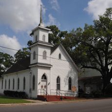
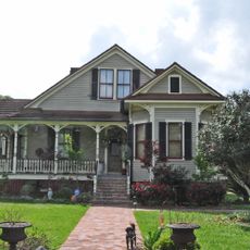
The county maintains its local heritage through community programs and preservation efforts that reflect the traditions of its towns. These initiatives help residents and visitors understand the region's development and connection to Texas history.

County services are located in Stephenville and handle voter registration and administrative matters. The different towns in the area are accessible by regional roads, making it easy to visit multiple municipalities.

The area contains several independent towns that each maintain their own postal identities and local character. This allows visitors to experience distinct communities within a single county region.

The community of curious travelers

AroundUs brings together thousands of curated places, local tips, and hidden gems, enriched daily by 60,000 contributors worldwide.

Start exploring
Location
Elevation above the sea
21 m
GPS coordinates
29.95826,-92.03596
Latest update
December 23, 2025 10:50
Around this place
Jungle Gardens
United States of America

Jungle Gardens

13.2 km
Palmetto Island State Park
United States of America

Palmetto Island State Park

14.9 km
Joseph Jefferson House
United States of America

Joseph Jefferson House

6.3 km
Darby Plantation
United States of America

Darby Plantation

21 km
St. Mary Magdalen Church
United States of America

St. Mary Magdalen Church

10 km
Downtown New Iberia Commercial Historic District
United States of America

Downtown New Iberia Commercial Historic District

21.5 km
Episcopal Church of the Epiphany
United States of America

Episcopal Church of the Epiphany

21.4 km
New Iberia High School
United States of America

New Iberia High School

21.3 km
St. Mary Congregational Church
United States of America

St. Mary Congregational Church

9.6 km
United States of America

Dulcito Plantation

19.3 km
The Magnolias
United States of America

The Magnolias

21.4 km
First United Methodist Church
United States of America

First United Methodist Church

21.4 km
United States of America

Beard Congregational Church

297 m
Jefferson Island Rip Van Winkle Gardens
United States of America

Jefferson Island Rip Van Winkle Gardens

6.2 km
Dr. Joseph Angel Villien House
United States of America

Dr. Joseph Angel Villien House

18.7 km
United States of America

Dupleix House

16.3 km
Sliman Theater for the Performing Arts
United States of America

Sliman Theater for the Performing Arts

21.7 km
United States of America

Abbeville Commercial Historic District

9.8 km
United States of America

Abbeville Residential Historic District

9.9 km
France

Plage du Cap Blanc-Nez

20.7 km
United States of America

Landry Plantation

13.5 km
United States of America

Le Triomphe Golf and Country Club

17.4 km
United States of America

Les Vieux Chenes Municipal Golf Course

20.4 km
United States of America

Vermilion Oaks Country Club

11.9 km
United States of America

Spanish Trail Golf Course

19.5 km
United States of America

Squirrel Run Golf Club

21.4 km
United States of America

Avery Island Experience

13.2 km
United States of America

Miramar Beach

17 km
Show the full map
Reviews
Share your experience

No review yet

Discussions
Start a discussion...

No discussion yet

« Erath - Administrative county in Texas, United States » is provided by Around Us (aroundus.com). Images and texts are derived from Wikimedia project under a Creative Commons license. You are allowed to copy, distribute, and modify copies of this page, under the conditions set by the license, as long as this note is clearly visible.

Discover hidden gems everywhere you go!

From secret cafés to breathtaking viewpoints, skip the crowded tourist spots and find places that match your style. Our app makes it easy with voice search, smart filtering, route optimization, and insider tips from travelers worldwide. Download now for the complete mobile experience.

Around Us App Screenshot

A unique approach to discovering new places

Le Figaro

All the places worth exploring

France Info

A tailor-made excursion in just a few clicks

20 Minutes

Around Us
Travel Guide & Maps
Download

Send to your phone

QR Code
1

Open the camera app on your mobile.

2

Point at the QR code with your camera. A notification will appear.

3

Tap the notification to open the link.