Enable Location

We need your location to show you interesting places around you

Discover nearby places

Find interesting locations and hidden gems around you

Precise directions

Get accurate directions and distances to places

Your location is never shared with other users. It's only used when you tap the location button.

Clarksdale

Log in to your account

Start exploring — it's free

Trusted by 61,893 travelers worldwide

Continue with Google
Continue with Apple
or

We will send you a code to connect

By continuing, you accept our Terms and Conditions and our Privacy Policy

Check your inbox

We've sent a pincode in your inbox. Please enter the code below.

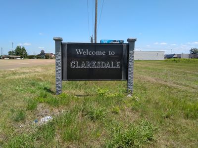
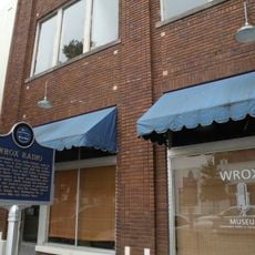
Clarksdale, Blues music capital in Mississippi, United States

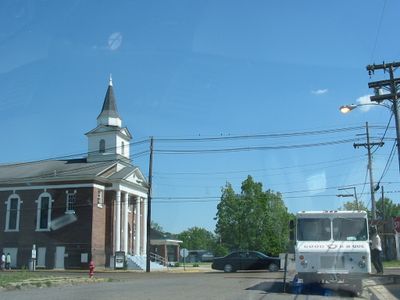
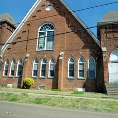
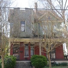
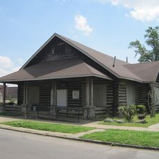
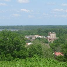
Clarksdale is a town in Coahoma County within the Mississippi Delta, situated along the Sunflower River where wide streets cross flat terrain. The downtown area consists of low brick buildings lining main roads that follow the paths of old Native American trading routes.

John Clark founded a settlement with a timber mill in 1848 at the crossroads of two old trading paths that later became major transport routes. During the 20th century, the town grew into a center of cotton production and drew many musicians who shaped Delta blues here.

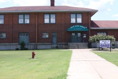
At the Crossroads in the center of town, where Highway 61 meets Highway 49, visitors stand where Robert Johnson is said to have struck his legendary deal, and the spot remains a pilgrimage site for blues fans. Clubs along Issaquena Avenue open nightly, and those who step inside often hear local musicians playing Delta blues in its original form.

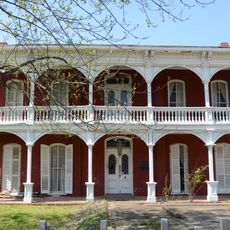
Those visiting the town find lodging in local guesthouses and larger hotels, with most places easily reached on foot or by car. Music events happen every day of the week, so travelers do not need to time their arrival for a specific date.

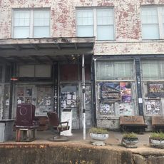
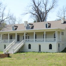
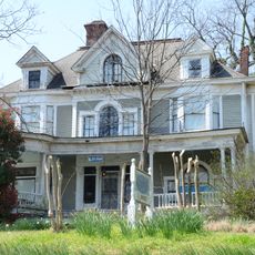
The Riverside Hotel, once a hospital, became lodging for traveling musicians and housed Bessie Smith and Robert Nighthawk during their tours. Visitors today can walk through the rooms and see original furniture that still remains from that era.

The community of curious travelers

AroundUs brings together thousands of curated places, local tips, and hidden gems, enriched daily by 60,000 contributors worldwide.

Start exploring
Location
Inception
1848
Elevation above the sea
53 m
Shares border with
Tunica
GPS coordinates
34.20064,-90.57022
Latest update
December 12, 2025 23:29
Around this place
Ground Zero
United States of America

Ground Zero

403 m
Helena Bridge
United States of America

Helena Bridge

33 km
St. Mary's Catholic Church
United States of America

St. Mary's Catholic Church

35.9 km
Delta Cultural Center
United States of America

Delta Cultural Center

35.8 km
Fort Curtis
United States of America

Fort Curtis

36.2 km
Centennial Baptist Church
United States of America

Centennial Baptist Church

36.2 km
Tallahatchie County Second District Courthouse
United States of America

Tallahatchie County Second District Courthouse

31.6 km
United States of America

Mississippi Delta National Heritage Area

16.9 km
United States of America

New Light Missionary Baptist Church

35.8 km
United States of America

John Clark House

749 m
William A. Short House
United States of America

William A. Short House

35.4 km
Phillips County Courthouse
United States of America

Phillips County Courthouse

36.5 km
William Nicholas Straub House
United States of America

William Nicholas Straub House

36.4 km
Allin House
United States of America

Allin House

36.4 km
Estevan Hall
United States of America

Estevan Hall

34.9 km
Keesee House
United States of America

Keesee House

35.8 km
United States of America

Murphey-Jennings House

31.9 km
Richard L. Kitchens Post No. 41
United States of America

Richard L. Kitchens Post No. 41

36.5 km
West House
United States of America

West House

36.4 km
United States of America

Lakeview Resettlement Project Historic District

31.2 km
Emmett Till Interpretive Center
United States of America

Emmett Till Interpretive Center

31.5 km
United States of America

Jackson Point

30.2 km
United States of America

Dixie Youth Park

1.8 km
United States of America

Kangaroo Point

21.8 km
Battery C Site
United States of America

Battery C Site

36.1 km
Battery D
United States of America

Battery D

35.4 km
WROX Building
United States of America

WROX Building

423 m
United States of America

Cherry Street Historic District

36.3 km
Show the full map
« Clarksdale - Blues music capital in Mississippi, United States » is provided by Around Us (aroundus.com). Images and texts are derived from Wikimedia project under a Creative Commons license. You are allowed to copy, distribute, and modify copies of this page, under the conditions set by the license, as long as this note is clearly visible.

Discover hidden gems everywhere you go!

From secret cafés to breathtaking viewpoints, skip the crowded tourist spots and find places that match your style. Our app makes it easy with voice search, smart filtering, route optimization, and insider tips from travelers worldwide. Download now for the complete mobile experience.

Around Us App Screenshot

A unique approach to discovering new places

Le Figaro

All the places worth exploring

France Info

A tailor-made excursion in just a few clicks

20 Minutes

Around Us
Travel Guide & Maps
Download

Send to your phone

QR Code
1

Open the camera app on your mobile.

2

Point at the QR code with your camera. A notification will appear.

3

Tap the notification to open the link.