Enable Location

We need your location to show you interesting places around you

Discover nearby places

Find interesting locations and hidden gems around you

Precise directions

Get accurate directions and distances to places

Your location is never shared with other users. It's only used when you tap the location button.

Ubaté

Log in to your account

Start exploring — it's free

Trusted by 65,190 travelers worldwide

Continue with Google
Continue with Apple
or

We will send you a code to connect

By continuing, you accept our Terms and Conditions and our Privacy Policy

Check your inbox

We've sent a pincode in your inbox. Please enter the code below.

Discussion Reviews 1 Photos
32.8k Popularity

Ubaté, Mountain municipality in Cundinamarca, Colombia.

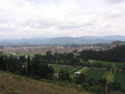
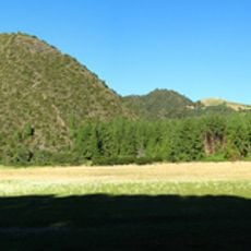
Ubaté is a municipality in the high Andes of Colombia, located at 2,556 meters elevation in the Ubaté-Chiquinquirá Valley. The town sits about 97 kilometers north of Bogotá and has a temperate mountain climate with temperatures ranging between 12 and 20 degrees Celsius.

Bernardo de Albornoz founded the Villa de San Diego de Ubaté in 1592 in an area previously inhabited by Muisca communities. The settlement emerged during the period when Spanish colonizers took root in the region and established new structures.

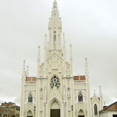
The Gothic cathedral and San Luis Convent show the Christian architecture that shapes this region. The town is known for dairy farming and how local farmers keep their animals on the highland pastures.

The town sits conveniently positioned between Boyacá to the north and Rionegro to the west, with regular transportation links to Bogotá. Visitors should prepare for cool mountain weather and bring sturdy shoes for the uneven streets.

The name comes from the Muisca word Ebate, meaning "bloodied land," which points to the pre-colonial history of the area. This indigenous heritage lives on in local identity, though today it is mainly found in place names.

The community of curious travelers

AroundUs brings together thousands of curated places, local tips, and hidden gems, enriched daily by 60,000 contributors worldwide.

Start exploring
Inception
1592
Elevation above the sea
2,556 m
GPS coordinates
5.30722,-73.81444
Latest update
December 20, 2025 00:07
Reviews
Share your experience

No review yet

Discussions
Start a discussion...

No discussion yet

« Ubaté - Mountain municipality in Cundinamarca, Colombia » is provided by Around Us (aroundus.com). Images and texts are derived from Wikimedia project under a Creative Commons license. You are allowed to copy, distribute, and modify copies of this page, under the conditions set by the license, as long as this note is clearly visible.

Discover hidden gems everywhere you go!

From secret cafés to breathtaking viewpoints, skip the crowded tourist spots and find places that match your style. Our app makes it easy with voice search, smart filtering, route optimization, and insider tips from travelers worldwide. Download now for the complete mobile experience.

Around Us App Screenshot

A unique approach to discovering new places

Le Figaro

All the places worth exploring

France Info

A tailor-made excursion in just a few clicks

20 Minutes

Around Us
Travel Guide & Maps
Download

Send to your phone

QR Code
1

Open the camera app on your mobile.

2

Point at the QR code with your camera. A notification will appear.

3

Tap the notification to open the link.