Chest opened
+${chestReward.xp} XP
Explorer
NOUVEAU ×${chestReward.collectible.quantity}
tapez pour fermer
Chest locked

Open chests in the app

Around Us is built for your phone — chests unlock when you walk, explore and capture nearby places.

Enable Location

We need your location to show you interesting places around you

Discover nearby places

Find interesting locations and hidden gems around you

Precise directions

Get accurate directions and distances to places

Your location is never shared with other users. It's only used when you tap the location button.

Log in to your account

Start exploring — it's free

Trusted by 72,888 travelers worldwide

Continue with Google
Continue with Apple
or

We will send you a code to connect

By continuing, you accept our Terms and Conditions and our Privacy Policy

Check your inbox

We've sent a pincode in your inbox. Please enter the code below.

Macanal Formation
Discussion Reviews Photo
1.4k Popularity

Macanal Formation, Geological formation in Eastern Cordillera, Colombia.

The Macanal Formation is a geological layer sequence in Colombia's Eastern Cordillera consisting of organic shale, limestone, and gypsum stacked in alternating beds. These materials reach a substantial depth as you move downward through the rock layers.

It formed during the Early Cretaceous period across the Berriasian and Valanginian time intervals through extensive tectonic movements. Over millions of years, marine sediments accumulated and compacted to create the rock layers visible today.

The name comes from the Muysca language and refers to either a wooden club or a native palm tree species found in the region. This linguistic connection reflects how the landscape has been understood by communities living here for generations.

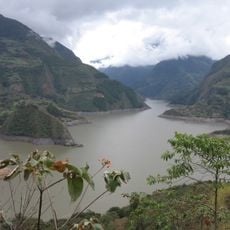
You can observe exposed rock sections at multiple roadside locations, especially along the road from Bogota to Villavicencio. The clearest views of the layers appear in the Bata River canyon, where the formations stand out against the valley walls.

This rock sequence contains emeralds that hold significant commercial value for the region and are sought globally. Simultaneously, it also functions as a source material for petroleum and natural gas extraction in surrounding areas.

The community of curious travelers

AroundUs brings together thousands of curated places, local tips, and hidden gems, enriched daily by 60,000 contributors worldwide.

Start exploring
GPS coordinates
4.97194,-73.31944
Latest update
March 18, 2026 03:28
Reviews
Share your experience

No review yet

Discussions
Start a discussion...

No discussion yet

« Macanal Formation - Geological formation in Eastern Cordillera, Colombia » is provided by Around Us (aroundus.com). Images and texts are derived from Wikimedia project under a Creative Commons license. You are allowed to copy, distribute, and modify copies of this page, under the conditions set by the license, as long as this note is clearly visible.

Discover hidden gems everywhere you go!

From secret cafés to breathtaking viewpoints, skip the crowded tourist spots and find places that match your style. Our app makes it easy with voice search, smart filtering, route optimization, and insider tips from travelers worldwide. Download now for the complete mobile experience.

Around Us App Screenshot

A unique approach to discovering new places

Le Figaro

All the places worth exploring

France Info

A tailor-made excursion in just a few clicks

20 Minutes

Around Us
Travel Guide & Maps
Download

Send to your phone

QR Code
1

Open the camera app on your mobile.

2

Point at the QR code with your camera. A notification will appear.

3

Tap the notification to open the link.