Enable Location

We need your location to show you interesting places around you

Discover nearby places

Find interesting locations and hidden gems around you

Precise directions

Get accurate directions and distances to places

Your location is never shared with other users. It's only used when you tap the location button.

Inagua

Log in to your account

Start exploring — it's free

Trusted by 62,170 travelers worldwide

Continue with Google
Continue with Apple
or

We will send you a code to connect

By continuing, you accept our Terms and Conditions and our Privacy Policy

Check your inbox

We've sent a pincode in your inbox. Please enter the code below.

Inagua, Island district in the southern Bahamas.

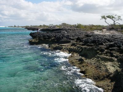
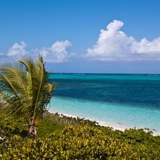
Inagua is an island district in the southern Bahamas covering 596 square miles of territory. The landscape includes salt flats, coastal wetlands, and dry forests with the highest point reaching 33 meters above sea level.

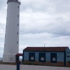
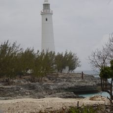
The island was called Heneagua by Spanish explorers between 1500 and 1825, a period when many ships wrecked on surrounding reefs. These maritime disasters left marks on the local geography and shaped settlement patterns.

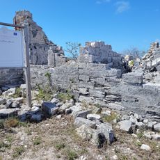
Matthew Town reflects influences from Africa, Europe, and the Caribbean in how its buildings look and how residents gather for celebrations. Local traditions shape the character of daily life in this small coastal community.

Scheduled flights from Nassau or boat services bring visitors to the island, with most accommodations located in Matthew Town near the salt facility. Having your own transportation helps explore the wider landscape.

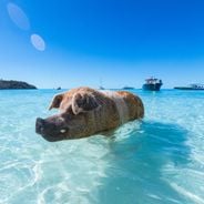
Lake Windsor sits in the island's interior as a freshwater body spanning 12 miles, occupying roughly one-quarter of the land. This water provides a home for about 80,000 West Indian flamingos in their natural surroundings.

The community of curious travelers

AroundUs brings together thousands of curated places, local tips, and hidden gems, enriched daily by 60,000 contributors worldwide.

Start exploring
Location
Inception
1800
Capital city
Matthew Town
Elevation above the sea
33 m
GPS coordinates
21.07681,-73.28705
Latest update
December 19, 2025 22:11
Bahamas: pink sand beaches, turquoise lagoons, islands and fishing villages

The Bahamas are a group of islands where each one has its own special features. You will see beaches with white or pink sand, clear water lagoons, and many kinds of sea life. From Nassau, the main city for visitors and government, to Eleuthera with its fishing villages, the islands invite you to see...

« Inagua - Island district in the southern Bahamas » is provided by Around Us (aroundus.com). Images and texts are derived from Wikimedia project under a Creative Commons license. You are allowed to copy, distribute, and modify copies of this page, under the conditions set by the license, as long as this note is clearly visible.

Discover hidden gems everywhere you go!

From secret cafés to breathtaking viewpoints, skip the crowded tourist spots and find places that match your style. Our app makes it easy with voice search, smart filtering, route optimization, and insider tips from travelers worldwide. Download now for the complete mobile experience.

Around Us App Screenshot

A unique approach to discovering new places

Le Figaro

All the places worth exploring

France Info

A tailor-made excursion in just a few clicks

20 Minutes

Around Us
Travel Guide & Maps
Download

Send to your phone

QR Code
1

Open the camera app on your mobile.

2

Point at the QR code with your camera. A notification will appear.

3

Tap the notification to open the link.