Enable Location

We need your location to show you interesting places around you

Discover nearby places

Find interesting locations and hidden gems around you

Precise directions

Get accurate directions and distances to places

Your location is never shared with other users. It's only used when you tap the location button.

Gilchrist County

Log in to your account

Start exploring — it's free

Trusted by 63,551 travelers worldwide

Continue with Google
Continue with Apple
or

We will send you a code to connect

By continuing, you accept our Terms and Conditions and our Privacy Policy

Check your inbox

We've sent a pincode in your inbox. Please enter the code below.

Discussion Reviews 1 Photos
24.7k Popularity

Gilchrist County, Administrative division in Florida, United States

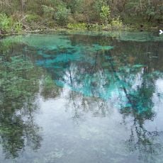
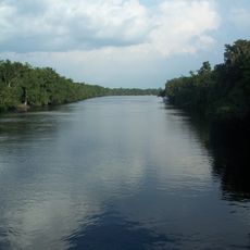
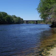
Gilchrist County spans North Central Florida and is shaped by natural features that define its landscape. The Suwannee River forms its western boundary, while numerous natural springs dot the terrain throughout the region.

The county was established in 1925, making it one of Florida's newer administrative divisions. Its naming after Governor Albert W. Gilchrist, who served from 1909 to 1913, preserves a connection to that era of state leadership.

The name honors Albert W. Gilchrist, a former Florida governor, and reflects the region's connection to its leaders. Residents maintain a strong bond with the river and natural springs that have shaped daily life here for generations.

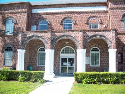
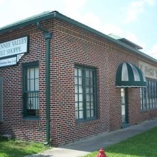
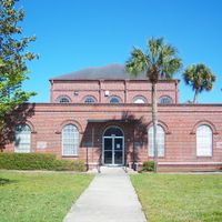
The county seat is located in Trenton and serves as the hub for local services. Visitors seeking information about the area or administrative matters can find resources and assistance there.

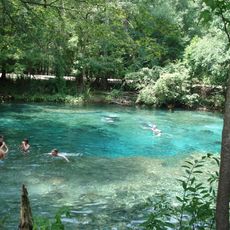
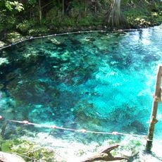
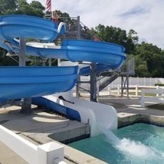
Blue Springs Park offers year-round swimming in thermally stable water fed by underground springs. This natural feature makes the park a local destination where water conditions remain constant regardless of the season.

The community of curious travelers

AroundUs brings together thousands of curated places, local tips, and hidden gems, enriched daily by 60,000 contributors worldwide.

Start exploring
Location
Inception
December 4, 1925
Capital city
Trenton
Reference
12-041
Shares border with
Columbia County, Alachua County, Levy County, Dixie County, Suwannee County, Lafayette County
GPS coordinates
29.73000,-82.80000
Latest update
December 20, 2025 12:13
Around this place
Ginnie Springs
United States of America

Ginnie Springs

15.3 km
Ichetucknee Springs State Park
United States of America

Ichetucknee Springs State Park

26.5 km
Fanning Springs State Park
United States of America

Fanning Springs State Park

20.6 km
United States of America

Gilchrist Blue Springs State Park

15.8 km
United States of America

River Rise Preserve State Park

23.7 km
City of Hawkinsville
United States of America

City of Hawkinsville

21.4 km
Coca-Cola Bottling Plant
United States of America

Coca-Cola Bottling Plant

12.7 km
Gilchrist County Courthouse
United States of America

Gilchrist County Courthouse

13.1 km
First Baptist Church
United States of America

First Baptist Church

13 km
Old Town Elementary School
United States of America

Old Town Elementary School

23.4 km
Newberry Historic District
United States of America

Newberry Historic District

20.3 km
Trenton Church of Christ
United States of America

Trenton Church of Christ

13.2 km
Old Town Methodist Church
United States of America

Old Town Methodist Church

22.8 km
United States of America

Andrews Wildlife Management Area

22.2 km
Fort White Public School Historic District
United States of America

Fort White Public School Historic District

23.4 km
Cannon Farm
United States of America

Cannon Farm

11.9 km
South Brooksville Avenue Historic District
United States of America

South Brooksville Avenue Historic District

23 km
Sikes House
United States of America

Sikes House

23 km
United States of America

Fort White Wildlife and Environmental Area

20 km
High Springs Historic District
United States of America

High Springs Historic District

22.3 km
River Ranch Waterpark
United States of America

River Ranch Waterpark

24.6 km
Joe H. Anderson Sr. Bridge
United States of America

Joe H. Anderson Sr. Bridge

20.6 km
United States of America

Spring Pond

14.7 km
United States of America

McMillan Bluff

15.6 km
United States of America

Ichetucknee Springs

28.5 km
United States of America

Raulison Pond

15.5 km
United States of America

Trenton Train Station

12.8 km
United States of America

High Springs Community Theater

22.5 km
Show the full map
Reviews
Share your experience

No review yet

Discussions
Start a discussion...

No discussion yet

Administrative divisions
« Gilchrist County - Administrative division in Florida, United States » is provided by Around Us (aroundus.com). Images and texts are derived from Wikimedia project under a Creative Commons license. You are allowed to copy, distribute, and modify copies of this page, under the conditions set by the license, as long as this note is clearly visible.

Discover hidden gems everywhere you go!

From secret cafés to breathtaking viewpoints, skip the crowded tourist spots and find places that match your style. Our app makes it easy with voice search, smart filtering, route optimization, and insider tips from travelers worldwide. Download now for the complete mobile experience.

Around Us App Screenshot

A unique approach to discovering new places

Le Figaro

All the places worth exploring

France Info

A tailor-made excursion in just a few clicks

20 Minutes

Around Us
Travel Guide & Maps
Download

Send to your phone

QR Code
1

Open the camera app on your mobile.

2

Point at the QR code with your camera. A notification will appear.

3

Tap the notification to open the link.