Enable Location

We need your location to show you interesting places around you

Discover nearby places

Find interesting locations and hidden gems around you

Precise directions

Get accurate directions and distances to places

Your location is never shared with other users. It's only used when you tap the location button.

Laurens County

Log in to your account

Start exploring — it's free

Trusted by 63,683 travelers worldwide

Continue with Google
Continue with Apple
or

We will send you a code to connect

By continuing, you accept our Terms and Conditions and our Privacy Policy

Check your inbox

We've sent a pincode in your inbox. Please enter the code below.

Discussion Reviews 1 Photos
22.3k Popularity

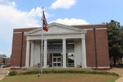
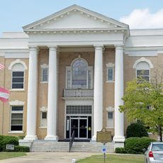
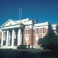
Laurens County, County administrative division in Georgia, United States.

Laurens County sits in central Georgia and encompasses rivers, forests, and farmland within its boundaries. The area is crossed by several state roads and forms a network of rural communities and smaller towns.

The county was created in 1807 and named after a Revolutionary War officer, reflecting the region's ties to early American history. Its founding marked a turning point in the settlement of central Georgia.

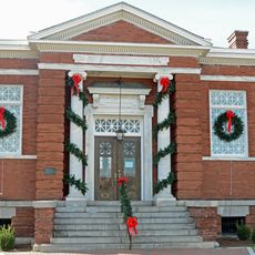
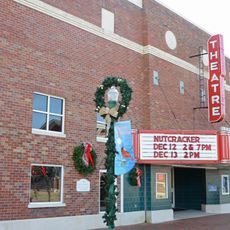
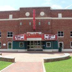
Dublin, the county seat, hosts regular events that showcase regional music, crafts, and traditional cooking throughout the year. These gatherings reflect how local communities celebrate their heritage and maintain connections to their shared past.

Interstate 16, U.S. Route 80, and U.S. Route 441 connect the county to larger cities for easy travel. Schools and services are spread throughout the area, so planning ahead helps when visiting multiple locations.

Two major river systems meet within this territory and create distinct living environments side by side. This intersection makes the county a compelling place to observe local ecology.

The community of curious travelers

AroundUs brings together thousands of curated places, local tips, and hidden gems, enriched daily by 60,000 contributors worldwide.

Start exploring
Location
Inception
December 10, 1807
Capital city
Dublin
Shares border with
Johnson County, Dodge County, Emanuel County, Treutlen County, Wheeler County, Bleckley County, Wilkinson County, Twiggs County
GPS coordinates
32.46000,-82.93000
Latest update
December 22, 2025 19:01
Around this place
Peabody School
United States of America

Peabody School

38.1 km
Williamson Mausoleum at Orphans Cemetery
United States of America

Williamson Mausoleum at Orphans Cemetery

39 km
Dodge County Courthouse
United States of America

Dodge County Courthouse

37 km
Carnegie Library
United States of America

Carnegie Library

7.2 km
Stubbs Park–Stonewall Street Historic District
United States of America

Stubbs Park–Stonewall Street Historic District

8.5 km
Glenwood High School
United States of America

Glenwood High School

39.4 km
United States of America

Herschel Lovett Bridge

10 km
William Pitt Eastman House
United States of America

William Pitt Eastman House

37.3 km
Wheeler County Courthouse
United States of America

Wheeler County Courthouse

37.4 km
Dublin Commercial Historic District
United States of America

Dublin Commercial Historic District

9.1 km
United States of America

Crystal Theater (Dublin, Georgia)

9.2 km
United States of America

Sanders Hill

23.8 km
Theatre Dublin
United States of America

Theatre Dublin

9 km
United States of America

Berry Hill Bluff

22.7 km
United States of America

Ben Hall Lake

21.6 km
United States of America

Bedingfield Lake

18.9 km
United States of America

Silver Bluff

30.9 km
United States of America

Magnolia Theater

37.2 km
United States of America

Thunder Springs Lake

22.5 km
United States of America

Williams Bluff

32.5 km
United States of America

Princess Theatre

37.4 km
United States of America

Rose Theatre

9.1 km
United States of America

Red Bluff

31.5 km
United States of America

Dublin-Laurens County Museum

8.7 km
United States of America

Chappells Pond

25.4 km
United States of America

Smalley Lake

19.8 km
United States of America

Riverview Golf Course

7.9 km
United States of America

Statue, Work of art

37 km
Show the full map
Reviews
Share your experience

No review yet

Discussions
Start a discussion...

No discussion yet

Administrative divisions
« Laurens County - County administrative division in Georgia, United States » is provided by Around Us (aroundus.com). Images and texts are derived from Wikimedia project under a Creative Commons license. You are allowed to copy, distribute, and modify copies of this page, under the conditions set by the license, as long as this note is clearly visible.

Discover hidden gems everywhere you go!

From secret cafés to breathtaking viewpoints, skip the crowded tourist spots and find places that match your style. Our app makes it easy with voice search, smart filtering, route optimization, and insider tips from travelers worldwide. Download now for the complete mobile experience.

Around Us App Screenshot

A unique approach to discovering new places

Le Figaro

All the places worth exploring

France Info

A tailor-made excursion in just a few clicks

20 Minutes

Around Us
Travel Guide & Maps
Download

Send to your phone

QR Code
1

Open the camera app on your mobile.

2

Point at the QR code with your camera. A notification will appear.

3

Tap the notification to open the link.