Enable Location

We need your location to show you interesting places around you

Discover nearby places

Find interesting locations and hidden gems around you

Precise directions

Get accurate directions and distances to places

Your location is never shared with other users. It's only used when you tap the location button.

Effingham County

Log in to your account

Start exploring — it's free

Trusted by 63,682 travelers worldwide

Continue with Google
Continue with Apple
or

We will send you a code to connect

By continuing, you accept our Terms and Conditions and our Privacy Policy

Check your inbox

We've sent a pincode in your inbox. Please enter the code below.

Discussion Reviews 1 Photos
25.8k Popularity

Effingham County, Administrative division in southeastern Georgia, United States.

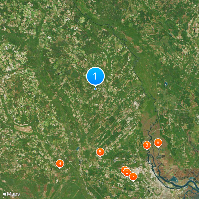
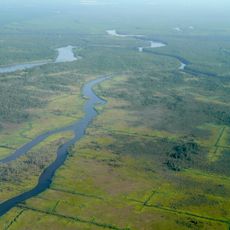
Effingham County is an administrative division in southeastern Georgia that spans farmland, river valleys, and small communities. The landscape is shaped by the floodplains of the Ogeechee and Savannah Rivers, which define the terrain and environment.

The county was founded in 1777 during the American Revolution and named after Thomas Howard, 3rd Earl of Effingham, who opposed British colonial rule. Its creation reflected the region's commitment to the independence movement.

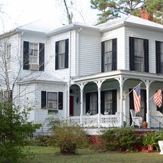
The annual Effingham County Fair displays local farming, crafts, and regional traditions that bring residents and visitors together. These gatherings reflect the pace of rural life and what community means to people here.

The area is well connected via Interstate 16 and Interstate 95 for access to larger cities and ports. Visitors should plan to explore by car and use local roads to move through the region.

The area contains the ghost town of Ebenezer and sections of the Savannah National Wildlife Refuge, where history and nature conservation stand side by side. Visitors can see abandoned settlements and protected habitats that together tell the story of local heritage.

The community of curious travelers

AroundUs brings together thousands of curated places, local tips, and hidden gems, enriched daily by 60,000 contributors worldwide.

Start exploring
Location
Inception
February 5, 1777
Capital city
Springfield
Shares border with
Hampton County, Bryan County, Jasper County, Chatham County, Bulloch County, Screven County
GPS coordinates
32.37000,-81.34000
Latest update
December 20, 2025 16:01
Around this place
National Museum of the Mighty Eighth Air Force
United States of America

National Museum of the Mighty Eighth Air Force

30 km
United States of America

Mulberry Grove Plantation

26.2 km
Savannah National Wildlife Refuge
United States of America

Savannah National Wildlife Refuge

28.2 km
United States of America

Roebling Road Raceway

22.4 km
5 Star Family Fun Park
United States of America

5 Star Family Fun Park

30.9 km
First Baptist Church
United States of America

First Baptist Church

32.9 km
Glen Echo
United States of America

Glen Echo

28.6 km
United States of America

Savannah Coastal Refuges Complex

28.2 km
Robertville Baptist Church
United States of America

Robertville Baptist Church

27.4 km
Old Effingham County Courthouse
United States of America

Old Effingham County Courthouse

2.2 km
Harris-Murrow-Trowell House
United States of America

Harris-Murrow-Trowell House

24.3 km
Guyton Historic District
United States of America

Guyton Historic District

6.3 km
J.C. Richardson House
United States of America

J.C. Richardson House

27.6 km
Boeing B-47 Stratojet
United States of America

Boeing B-47 Stratojet

29.8 km
F-4C Phantom
United States of America

F-4C Phantom

29.9 km
Mikoyan-Gurevich MiG-17A
United States of America

Mikoyan-Gurevich MiG-17A

29.9 km
United States of America

Bloomingdale History Museum and Visitor's Center

26.9 km
United States of America

Houston Praise House

21.5 km
United States of America

Port Wentworth City Hall

23.4 km
United States of America

Mars Theatre

2.7 km
United States of America

Pooler City Hall

29.6 km
United States of America

Bloomingdale City Hall

26.6 km
United States of America

Stokes Bluff

21.6 km
United States of America

Bear Bluff

17.2 km
United States of America

Palichucola Bluff

21.4 km
United States of America

Horse Bluff

17.1 km
United States of America

Saint Peters Bluff

14.6 km
United States of America

Drakies Bluff

27.5 km
Show the full map
Reviews
Share your experience

No review yet

Discussions
Start a discussion...

No discussion yet

Administrative divisions
« Effingham County - Administrative division in southeastern Georgia, United States » is provided by Around Us (aroundus.com). Images and texts are derived from Wikimedia project under a Creative Commons license. You are allowed to copy, distribute, and modify copies of this page, under the conditions set by the license, as long as this note is clearly visible.

Discover hidden gems everywhere you go!

From secret cafés to breathtaking viewpoints, skip the crowded tourist spots and find places that match your style. Our app makes it easy with voice search, smart filtering, route optimization, and insider tips from travelers worldwide. Download now for the complete mobile experience.

Around Us App Screenshot

A unique approach to discovering new places

Le Figaro

All the places worth exploring

France Info

A tailor-made excursion in just a few clicks

20 Minutes

Around Us
Travel Guide & Maps
Download

Send to your phone

QR Code
1

Open the camera app on your mobile.

2

Point at the QR code with your camera. A notification will appear.

3

Tap the notification to open the link.