Enable Location

We need your location to show you interesting places around you

Discover nearby places

Find interesting locations and hidden gems around you

Precise directions

Get accurate directions and distances to places

Your location is never shared with other users. It's only used when you tap the location button.

Cranbrook

Log in to your account

Start exploring — it's free

Trusted by 61,815 travelers worldwide

Continue with Google
Continue with Apple
or

We will send you a code to connect

By continuing, you accept our Terms and Conditions and our Privacy Policy

Check your inbox

We've sent a pincode in your inbox. Please enter the code below.

Cranbrook, Regional center in East Kootenay, British Columbia, Canada.

Description

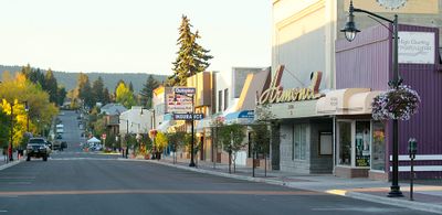
Cranbrook is a regional center in East Kootenay, British Columbia, Canada, located between the Rocky Mountains and Purcell Mountains at 921 meters (3,021 feet) elevation. The broad valley provides mild winters and sunny summers, with shops and services that supply surrounding communities.

History

Colonel James Baker acquired the land and named it after his hometown in Kent, England. The Canadian Pacific Railway built its Crowsnest Pass line in 1898, bringing new settlers and economic activity to the region.

Culture

The town takes its name from the founder's hometown in Kent county, England, and maintains that connection to this day. Community life centers on sports and cultural events where locals gather regularly.

Practical

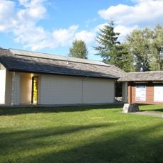
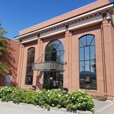
The Canadian Rockies International Airport connects the town to larger centers, while the East Kootenay Regional Hospital and College of the Rockies provide key facilities for the area. Most shops and services line the main streets downtown, where visitors can handle errands and find necessities.

Did you know?

The town records 2,190 hours of sunshine per year, making it the sunniest municipality in all of British Columbia. This exceptional climate draws visitors and residents who appreciate mild and bright weather throughout the year.

Inception
1898
Elevation above the sea
921 m
GPS coordinates
49.51360,-115.76900
Latest update
December 13, 2025 17:18

AroundUs brings together thousands of curated places, local tips, and hidden gems, enriched daily by 60,000 contributors worldwide. Discover all places nearby (Regional District of East Kootenay).

« Cranbrook - Regional center in East Kootenay, British Columbia, Canada » is provided by Around Us (aroundus.com). Images and texts are derived from Wikimedia project under a Creative Commons license. You are allowed to copy, distribute, and modify copies of this page, under the conditions set by the license, as long as this note is clearly visible.

Discover hidden gems everywhere you go!

From secret cafés to breathtaking viewpoints, skip the crowded tourist spots and find places that match your style. Our app makes it easy with voice search, smart filtering, route optimization, and insider tips from travelers worldwide. Download now for the complete mobile experience.

Around Us App Screenshot

A unique approach to discovering new places

Le Figaro

All the places worth exploring

France Info

A tailor-made excursion in just a few clicks

20 Minutes

Around Us
Travel Guide & Maps
Download

Send to your phone

QR Code
1

Open the camera app on your mobile.

2

Point at the QR code with your camera. A notification will appear.

3

Tap the notification to open the link.