Enable Location

We need your location to show you interesting places around you

Discover nearby places

Find interesting locations and hidden gems around you

Precise directions

Get accurate directions and distances to places

Your location is never shared with other users. It's only used when you tap the location button.

Belle Fourche

Log in to your account

Start exploring — it's free

Trusted by 62,855 travelers worldwide

Continue with Google
Continue with Apple
or

We will send you a code to connect

By continuing, you accept our Terms and Conditions and our Privacy Policy

Check your inbox

We've sent a pincode in your inbox. Please enter the code below.

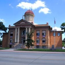
Belle Fourche, County seat in the Black Hills region, South Dakota, United States

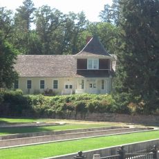
Belle Fourche is a city in South Dakota's Black Hills region, sitting at 921 meters on the northern slopes and serving as the county seat of Butte County. Today it functions as a regional commerce center connecting communities across several states.

The city began in 1895 as a key livestock shipping hub after Seth Bullock built rail infrastructure connecting the Black Hills region. These early transportation links allowed the area to market its resources and products efficiently.

The Black Hills Roundup draws thousands of visitors annually to celebrate regional cowboy traditions through rodeo competitions and western entertainment. The event shapes how locals see themselves as part of a ranching community.

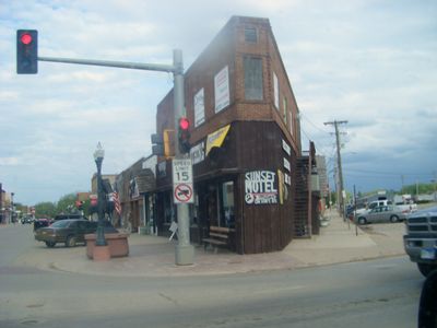
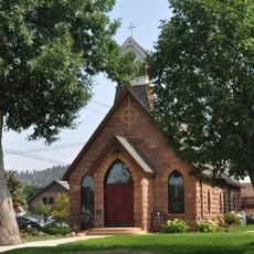
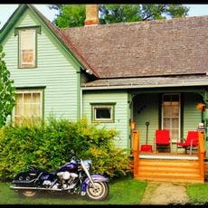
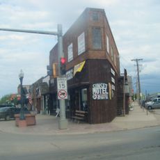
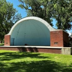
The downtown area is walkable and gives you access to local shops, restaurants, and public facilities that serve daily needs. The surrounding landscape also offers outdoor recreation and trails, especially for visitors interested in exploring the Black Hills terrain.

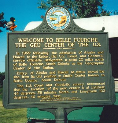
A monument marks the geographic center of the nation, a point determined by the U.S. Coast and Geodetic Survey in 1918. This site draws visitors curious about the symbolic heart of the country, though it sits quietly outside town.

The community of curious travelers

AroundUs brings together thousands of curated places, local tips, and hidden gems, enriched daily by 60,000 contributors worldwide.

Start exploring
Location
Elevation above the sea
921 m
Shares border with
Deadwood
GPS coordinates
44.66750,-103.85028
Latest update
December 14, 2025 19:58
Around this place
D.C. Booth Historic National Fish Hatchery
United States of America

D.C. Booth Historic National Fish Hatchery

20.8 km
Episcopal Church of All Angels
United States of America

Episcopal Church of All Angels

19.3 km
United States of America

Old Redwater Bridge

8.6 km
United States of America

Snoma Finnish Cemetery

13.6 km
First Congregational United Church of Christ
United States of America

First Congregational United Church of Christ

54 m
James A. Corbin House
United States of America

James A. Corbin House

20.2 km
Butte County Courthouse and Historic Jail Building
United States of America

Butte County Courthouse and Historic Jail Building

291 m
United States of America

Minnesela Bridge

3.7 km
United States of America

Woodmen Hall

16.9 km
Webb S. Knight House
United States of America

Webb S. Knight House

19.9 km
Thomas Haskins Gay House
United States of America

Thomas Haskins Gay House

310 m
United States of America

Hay Creek Bridge

292 m
Belle Fourche Commercial Historic District
United States of America

Belle Fourche Commercial Historic District

579 m
Belle Fourche Band Shell
United States of America

Belle Fourche Band Shell

110 m
United States of America

Walsh Barn

14.7 km
Arthur Hewes House
United States of America

Arthur Hewes House

19.7 km
United States of America

Matthews Opera House

19.8 km
United States of America

Lookout Amphitheater

20.3 km
United States of America

Belle Fourche Reservoir

13.7 km
United States of America

Belle Fourche Reservoir

13.7 km
United States of America

Belle Fourche Country Club

2.7 km
United States of America

Matthews Opera House

19.8 km
United States of America

Statue, Work of art

19.9 km
United States of America

Statue, Work of art

19.1 km
United States of America

National Register of Historic Places listed place, Work of art, sculpture

20 km
United States of America

Mirror Creek Falls

17.6 km
United States of America

Upper Windy Pine Falls

18.9 km
United States of America

Lower Windy Pine Falls

18.6 km
Show the full map
« Belle Fourche - County seat in the Black Hills region, South Dakota, United States » is provided by Around Us (aroundus.com). Images and texts are derived from Wikimedia project under a Creative Commons license. You are allowed to copy, distribute, and modify copies of this page, under the conditions set by the license, as long as this note is clearly visible.

Discover hidden gems everywhere you go!

From secret cafés to breathtaking viewpoints, skip the crowded tourist spots and find places that match your style. Our app makes it easy with voice search, smart filtering, route optimization, and insider tips from travelers worldwide. Download now for the complete mobile experience.

Around Us App Screenshot

A unique approach to discovering new places

Le Figaro

All the places worth exploring

France Info

A tailor-made excursion in just a few clicks

20 Minutes

Around Us
Travel Guide & Maps
Download

Send to your phone

QR Code
1

Open the camera app on your mobile.

2

Point at the QR code with your camera. A notification will appear.

3

Tap the notification to open the link.