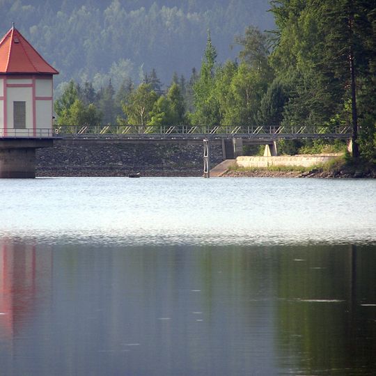
Chřibská Reservoir, reservoir in Rybniště, Czech Republic
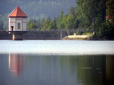
The Chřibská Reservoir lies on the upper Chřibská Kamenice, 2 km southeast of Horní Chřibská in the Rybniště cadastre, 1 km west of Malý Stožec. Its earth dam is 26 m high, 107 m wide at the base and 6 m at the crown, which runs 189 m; the dam holds over 170,000 m³. The reservoir covers 13 ha, reaches 20 m deep and holds over 1.06 million m³ of water.
Built between 1912 and 1924 on the upper Chřibská Kamenice, the reservoir was designed as a retarding basin to hold back flood waves. It later also served recreation, and since 1977 it has been a drinking-water reservoir, so bathing and other recreational activities are banned. The dam is 26 m high, 107 m wide at its base and 6 m at the crest, which is 189 m long.
Since 1977 the reservoir has supplied drinking water, so swimming and recreation are banned and the whole area is closed to visitors. The German name Kreibitzer Talsperre recalls the German-speaking population of the region around Horní Chřibská, called Oberkreibitz.
The dam is reached by a short turn-off from the local road linking Horní Chřibská with the Chřibská railway station on the Jedlová–Rumburk line. The asphalt forest road called Přehradní cesta, coming from Hraniční and Jedlovské rybníky, crosses the water protection zone and is closed to the public. Swimming and other recreation are banned because the reservoir supplies drinking water.
The dam wall holds over 170,000 m³ of material: 26 m high, 107 m wide at its base and 6 m at the crown, which runs 189 m. A 2 m high discharge gallery passes through it. The reservoir holds over 1.06 million m³ of water, up to 20 m deep, fed by a 6.28 km² catchment.
The community of curious travelers
AroundUs brings together thousands of curated places, local tips, and hidden gems, enriched daily by 94,920 contributors worldwide.