Pakpak Bharat, Mountainous regency in North Sumatra, Indonesia
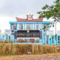
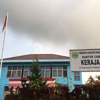
Pakpak Bharat is an administrative regency in North Sumatra covering mountainous terrain across eight districts with Salak as its main town. The region is characterized by highland geography that shapes the layout of communities and landscape.
The regency was established in 2003 as an independent administrative territory following separation from a neighboring district. This division marked the start of its development as a distinct administrative unit within the province.
The Pakpak people maintain their own cultural practices visible in daily community life and village traditions. Their social structures shape how residents interact and organize their shared spaces.
The region is accessible by road, though mountainous terrain affects routes and travel between settlements. Visitors should expect longer travel times and variable road conditions in highland areas.
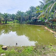
The territory is one of the least densely populated in its province, with a population density that remains quite low compared to surrounding areas. This sparse settlement gives the landscape a quiet, undeveloped character.
Location: North Sumatra
Capital city: Salak
Elevation above the sea: 693 m
Shares border with: Aceh Singkil, Subulussalam, Dairi, Samosir, Humbang Hasundutan, Central Tapanuli
Website: http://pakpakbharatkab.go.id
GPS coordinates: 2.56667,98.28333
Latest update: December 20, 2025 14:18
Kolam Pancing Kasman Lizar
29.8 kmRest area
31 kmWaterfall
37 kmSopo Guru Tatea Bulan
38.7 kmHadabuan Naisogop
37.8 kmPusat Informasi Toba Caldera UNESCO Global Geopark
39.1 kmKubah Lava Dasirik
38.6 kmCikalang water park
25.6 kmMenara Tele
39.7 kmBankinang
40.6 kmTugu Sawit
42.8 kmScenic viewpoint
23 kmTugu Bank Aceh Kota Subulussalam
32.4 kmBatu Hobon
38.5 kmRest stop
9.9 kmMasjid Agung Sidikalang
20.4 kmTugu Simpang Tiga Penanggalan
30 kmTugu Pena Penanggalan
28.1 kmGapura Dairi Tobasa
30.4 kmBatas Provinsi Aceh-Sumut
20.7 kmTugu Simpang ke Sibolga
35.5 kmWaterfall
37.1 kmWaterfall
37 kmWaterfall
30.4 kmAir Terjun Sampuran Efrata
40.3 kmBatu Parhusipan Si Boru Pareme
38.9 kmWaterfall
37.1 kmAir Terjun Lae Karebaran
20.3 kmVisited this place? Tap the stars to rate it and share your experience / photos with the community! Try now! You can cancel it anytime.
Discover hidden gems everywhere you go!
From secret cafés to breathtaking viewpoints, skip the crowded tourist spots and find places that match your style. Our app makes it easy with voice search, smart filtering, route optimization, and insider tips from travelers worldwide. Download now for the complete mobile experience.
A unique approach to discovering new places❞
— Le Figaro
All the places worth exploring❞
— France Info
A tailor-made excursion in just a few clicks❞
— 20 Minutes