Sangihe Islands, Volcanic archipelago in North Sulawesi, Indonesia
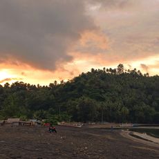
The Sangihe Islands comprise a chain of islands extending northward from Sulawesi, including Sangihe, Siau, Tahulandang, and Biaro as the main landmasses along with many smaller islets. The archipelago features volcanic terrain shaped by geological activity and coastal waterways.
Dutch colonial forces took control of the Sangihe Islands in 1677, establishing a long period of European administration. The territory became part of independent Indonesia following the end of colonial rule in 1945.
The local population speaks Sangir, an Austronesian language linked to northern Sulawesi and parts of the Philippines. This shared language binds communities together across the archipelago's islands.
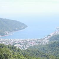
Tahuna, located on the west coast of Sangihe Island, serves as the regional administrative center with most services and government offices concentrated there. The Naha Airport provides the main air connection to the archipelago.
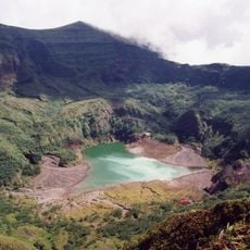
Mount Awu, an active volcano reaching 1,320 meters high on Sangihe Island, shapes the landscape and creates fertile soil for farming. This volcanic activity makes the islands geologically distinctive and influences local livelihoods.
The community of curious travelers
AroundUs brings together thousands of curated places, local tips, and hidden gems, enriched daily by 60,000 contributors worldwide.