Waldviertel narrow gauge railways, Heritage railway line in Lower Austria, Austria.
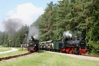
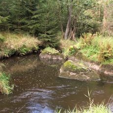
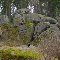
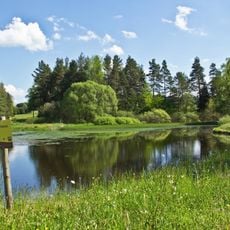
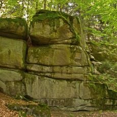
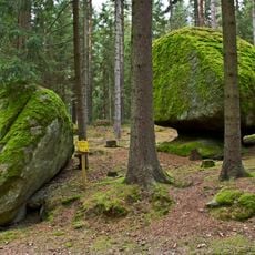
The Waldviertel narrow gauge railway is a narrow-gauge rail system that stretches about 82 kilometers through forests, ponds, and granite formations in the northern Waldviertel region. The network connects multiple towns and operates today with special trains that run through the landscape on regular routes.
The network was created in 1899 with the founding of a dedicated company and began operations in 1900. This early development was part of the region's industrialization and continues to shape its infrastructure today.
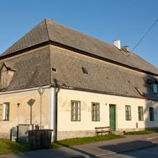
The railway connects communities like Gmünd, Litschau, and Heidenreichstein and shows how the region developed during early industrialization. Today trains move through a landscape shaped by forests and lakes that define the Waldviertel area.
Visitors can take rides throughout the year, with December offering special themed trains including Christmas Eve and New Year's Eve services. It is wise to check current schedules before visiting and prepare for changing weather conditions, as the route runs through open countryside.
The railway operates with a very narrow track gauge of 760 millimeters and maintains a maximum speed of 60 kilometers per hour. This special design allows the line to wind through the hilly Waldviertel without requiring major construction work in the landscape.
Location: Lower Austria
GPS coordinates: 48.78190,14.98560
Latest update: December 6, 2025 16:03
Austria extends well beyond Vienna and Salzburg. Away from major tourist routes lie natural monuments and historical sites that reveal the country's geological and cultural heritage. From the Eisriesenwelt ice caves near Werfen to medieval castles such as Hochosterwitz in Carinthia, this collection...
Dračice
12.5 km
Saint Andrew Church
9.5 km
Pfarrkirche Mariä Himmelfahrt, Langegg
7.1 km
Pfarrkirche Nagelberg
6.5 km
Ortskapelle Gopprechts
13.1 km
Ortskapelle Breitensee
2.4 km
Ortskapelle Steinbach, Brand-Nagelberg
5.1 km
Ortskapelle Thaures (Gemeinde Heidenreichstein)
11.9 km
Käs im Laibstein ("Cheese inside the loaf stone")
8.3 km
Geyersteine
11.6 km
NÖ-Naturdenkmal GD-022 Felsgebilde Hinterpocher
6.4 km
Harrteich
12.5 km
Gmünder Strandbad
3.8 km
NÖ-Naturdenkmal GD-036 Felsgebilde Granitblock-Gruppe
4.4 km
Church of Saint Sigismund
11.5 km
NÖ-Naturdenkmal GD-062 Felsgruppe Restlinge in Ludwigsthal
3 km
NÖ-Naturdenkmal GD-096 Granitfelsgruppe auf Waldkuppe
6.6 km
Kaiblstein ("Calf stone")
4.2 km
Neu Nagelberg railway station building
4.5 km
Jägersitz ("hunter's seat")
7.8 km
World War I memorial in Rapšach
11.5 km
NÖ-Naturdenkmal GD-021 Felsgebilde Pumperskirchen und Kanzel
4 km
Wohnhaus Steinbach 2, Brand-Nagelberg
5 km
Kasiger Loa
9.5 km
Pfarrhof
9.5 km
Kaple v Halámkách
8.7 km
NÖ-Naturdenkmal GD-061 Felsgebilde Kas- und Brotstein
3.1 km
NÖ-Naturdenkmal GD-102 Felsgebilde Striezel und Scherzel
9 kmVisited this place? Tap the stars to rate it and share your experience / photos with the community! Try now! You can cancel it anytime.
Discover hidden gems everywhere you go!
From secret cafés to breathtaking viewpoints, skip the crowded tourist spots and find places that match your style. Our app makes it easy with voice search, smart filtering, route optimization, and insider tips from travelers worldwide. Download now for the complete mobile experience.
A unique approach to discovering new places❞
— Le Figaro
All the places worth exploring❞
— France Info
A tailor-made excursion in just a few clicks❞
— 20 Minutes