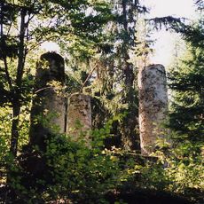
Arbesbach Castle, Castle ruin in Arbesbach, Austria
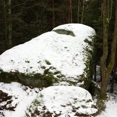
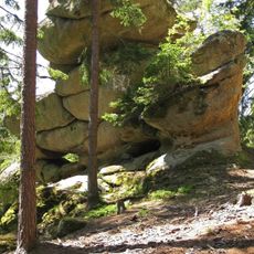
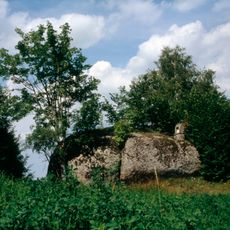
Arbesbach Castle is a castle ruin standing on a tall granite rock formation in the Waldviertel region of Lower Austria. The structure features a pentagonal tower that rises prominently from the stone base, forming the focal point of the entire complex.
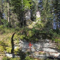
The castle was built at the end of the 12th century by Hadmar II of Kuenring as a supporting fortification for Rappottenstein Castle. In 1480, Bohemian troops destroyed the structure during military conflicts in the region.
The local name 'Molar of the Waldviertel' comes from how the tower sits on the rock, resembling a tooth rising from the landscape. People in the area still use this nickname when pointing out the structure.
Access to the ruin involves climbing 176 steps that lead to an observation platform at the tower's top. You can collect the access key from Huber Bakery in the village before starting your climb.
On clear days, the observation platform offers views of distant Alpine peaks, including Schneeberg and Dachstein mountains. This far-reaching perspective surprises many visitors who do not expect such distant vistas from this location.
Location: Arbesbach
GPS coordinates: 48.49440,14.96090
Latest update: December 9, 2025 12:21
Tanner Moor
7.3 km
Bear sanctuary Arbesbach
2.9 km
Lohnbachfall
5.2 km
Pfarrkirche Arbesbach
461 m
Steinerner Torbogen
5.1 km
Pfarrkirche Altmelon
6.9 km
Manor house in Arbesbach
459 m
Church of the Presentation of Jesus at the Temple
7.4 km
Höllfall
2.6 km
Filialkirche Pehendorf
6.4 km
Ortskapelle Haselbach
2.9 km
Ortskapelle Kleinpertenschlag
6.9 km
Hammerschmiede Kamp
1.2 km
Granite rock "Vogelstein"
3.8 km
Gallow, Arbesbach
1.1 km
Steinernes Bründl ("Stone well")
5.3 km
Rock formation at the state road 7315
2.1 km
Pfarrhof
385 m
Gletschermühle ("Glacier mill")
5.2 km
Pranger
413 m
Big granite boulder near Altmelon
4.2 km
Volksschule/Pfarrhof, ehem. Kloster
7.3 km
Wohnhaus
1.2 km
Niglstoan
2.7 km
Group of granite boulders near Pretrobruck
4.4 km
Rock formations on the Galgenberg
1.1 km
Balanced rock near Altmelon
3.5 km
Boulder fields south of Federal road 124
2.8 kmVisited this place? Tap the stars to rate it and share your experience / photos with the community! Try now! You can cancel it anytime.
Discover hidden gems everywhere you go!
From secret cafés to breathtaking viewpoints, skip the crowded tourist spots and find places that match your style. Our app makes it easy with voice search, smart filtering, route optimization, and insider tips from travelers worldwide. Download now for the complete mobile experience.
A unique approach to discovering new places❞
— Le Figaro
All the places worth exploring❞
— France Info
A tailor-made excursion in just a few clicks❞
— 20 Minutes