Feichtberg, Mountain summit in Kopfing im Innkreis, Austria
Description
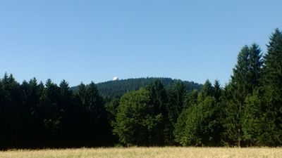
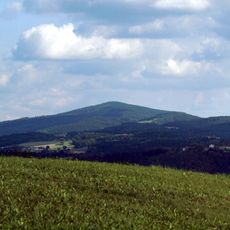
Feichtberg is a mountain summit in Kopfing im Innkreis that rises to 777 meters above the landscape. It forms part of the Sauwald range in Upper Austria and features a radar installation with distinctive dome-shaped structures on its peak.
History
A radar facility was established on the mountain in 1968 by Austria's Civil Aviation Authority. Management transferred to Austro Control in 1994, which operates it for the country's air traffic oversight.
Culture
The mountain connects three radar stations across Austria, forming a network with installations at Buschberg and Koralpe for national air traffic control.
Practical
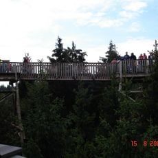
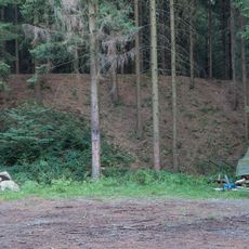
Multiple hiking trails circle the mountain with clear markings guiding visitors through forest paths and to viewpoints. The area is most easily accessible during warmer months, and routes offer varying difficulty levels for different abilities.
Did you know?
The large white radar domes on the summit resemble giant golf balls and are visible from considerable distances. These distinctive structures serve as a landmark in the region and define the mountain's appearance.
AroundUs brings together thousands of curated places, local tips, and hidden gems, enriched daily by 60,000 contributors worldwide. Discover all places nearby (Kopfing im Innkreis).
Engelszell Abbey
4.8 km
Jochenstein power station
5.6 km
Jochenstein
5.6 km
Baumkronenweg Kopfing
2.6 km
Haugstein
4.4 km
Burg Altjochenstein
6.2 km
Pfarrkirche Mariä Himmelfahrt, Engelhartszell
5.2 km
Pfarrkirche Kopfing
4 km
Pfarrkirche Sankt Aegidi
3.9 km
Pfarrkirche St. Roman
5.7 km
Filialkirche Stadl-Kicking
2.5 km
Friedhof Kopfing
4 km
Fallauerkapelle, Spätgotische Kreuzigungsgruppe
5.4 km
Engelhartszell - Hufschmiede
5.2 km
Schütz Art Museum
5.4 km
Bauernhaus Razing
5.6 km
Pfarrhof
5.7 km
Kriegerdenkmal Kopfing
4 km
Figur des hl. Johannes v. Nepomuk
5.5 km
Engelhartszell - Statue des heiligen Johannes Nepomuk
5.2 km
Pfarrhof Kopfing
4.1 km
Befestigungsanlage, Redoute u. Linienschanze Kleiner Schefberg
3.8 km
Amtsgebäude, Kulturhaus, ehem. Mauthaus
5.3 km
Amtsgebäude, Wohnbauten, ehem. Bezirksgericht
5 km
Pestsäule
5.2 km
Fischerlinden in Oberleiten
4.1 km
Lindengruppe in Mittelbach
5.8 km
Stuhlberger Linde
3.8 kmDiscover hidden gems everywhere you go!
From secret cafés to breathtaking viewpoints, skip the crowded tourist spots and find places that match your style. Our app makes it easy with voice search, smart filtering, route optimization, and insider tips from travelers worldwide. Download now for the complete mobile experience.
A unique approach to discovering new places❞
— Le Figaro
All the places worth exploring❞
— France Info
A tailor-made excursion in just a few clicks❞
— 20 Minutes