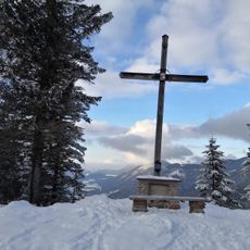
Schlenken, Mountain peak in Krispl, Austria
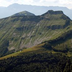
Schlenken is a mountain rising to about 1600 meters above sea level near Bad Vigaun, featuring steep rock faces mixed with gentler pastoral slopes. The varied terrain creates different routes through forested areas and open mountain pastures.
The Schlenken is a 1,648-metre peak of the Osterhorn group in the Salzburg district of Hallein. Its summit lies on the municipal boundary between Krispl and Bad Vigaun, with the south-west flank in Bad Vigaun and the north-east side mainly in Krispl, fringes belonging to Adnet. From afar its silhouette, paired with the Schmittenstein, resembles an extinct volcano.
The Schlenken area holds 11 alpine huts and pastures, four of them staffed, where herders have worked the slopes above Bad Vigaun and Krispl. The mountain's silhouette, likened to an extinct volcano, is recognised from afar together with the neighbouring Schmittenstein, 1.7 km away.
The summit sits on the boundary between Krispl and Bad Vigaun, with the southwest flank in Bad Vigaun and the northeast side mostly in Krispl, fringes in Adnet. Around 11 alpine huts and pastures lie in the Schlenken area, 4 of them staffed. The mountain is used for hiking, ski touring and paragliding.
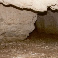
The Schlenken area holds around 25 caves, the best known being the Schlenken-Durchgangshöhle, a through-cave. The mountain's silhouette, often compared to an extinct volcano, is recognisable from far off together with the neighbouring Schmittenstein, 1.7 km away.
The community of curious travelers
AroundUs brings together thousands of curated places, local tips, and hidden gems, enriched daily by 93,635 contributors worldwide.