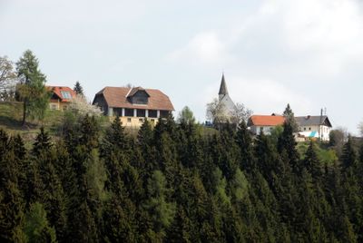
Lorenziberg, Mountain summit in Carinthia, Austria
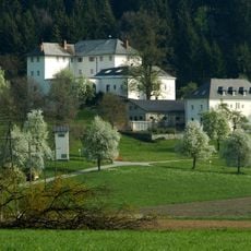
Lorenziberg is a mountain peak near Frauenstein in Carinthia that rises to approximately 970 meters. The surrounding area offers several marked trails at different difficulty levels that wind through Alpine landscapes.
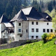
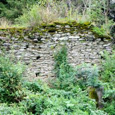
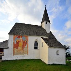
The mountain forms an important point along the Vierbergelauf, a traditional pilgrimage route that connects several peaks across Carinthia. This route has a long history as a place of devotion and gathering for pilgrims and walkers.
The mountain draws people from surrounding areas who spend time outdoors and gather with family and friends on its slopes. Regular groups explore the trails together, making it a place where locals and visitors share their enjoyment of the natural setting.
Most hikes start from nearby villages like Sörg and take roughly one and a half to two hours to reach the summit. Sturdy footwear and weather-appropriate clothing are important, as conditions at the top can be windy and cold.
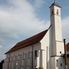
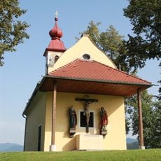
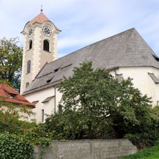
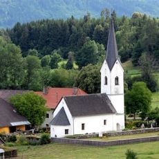
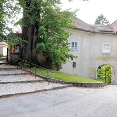
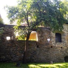
A small church dedicated to Saint Laurentius stands near one of the hiking trails and speaks to the spiritual meaning of this location. For many hikers, this chapel becomes a meaningful stop during their journey.
Location: Frauenstein
Part of: Vierbergelauf
GPS coordinates: 46.77288,14.31924
Latest update: December 13, 2025 17:09
Schloss Frauenstein
2.2 km
Burg Freiberg
2.5 km
Burgruine Nussberg
908 m
Schloss Dornhof, Frauenstein, Carinthia
934 m
Klosterkirche Unsere Liebe Frau, St. Veit an der Glan
2.8 km
Schloss Rosenbichl
2.3 km
Ehemaliges Bürgerspital, St Veit an der Glan
2.8 km
Ruine Schaumburg
2.8 km
Kalvarienbergkapelle St Veit
2.6 km
St. Veit Museum
2.9 km
Fortifications of Sankt Veit an der Glan
2.8 km
Filialkirche hl. Laurentius, Lorenziberg, Frauenstein
10 m
Pfarrkirche hl. Georg, Obermühlbach
1.9 km
Ehemalige Kirche Reidenau
2.5 km
Kirche St. Oswald
1 km
Tierfriedhof Delphi
2.3 km
Sankt Veit an der Glan - Rosengarten
2.8 km
Filialkirche hl. Margareta, Treffelsdorf
1.5 km
Verkehrsmuseum
2.9 km
Estate Gieselhof
2.4 km
Vitusbrunnen St Veit an der Glan
2.3 km
Spital der Barmherzigen Brüder - Sankt Veit an der Glan
2.6 km
Pfarrhof Obermühlbach
1.9 km
Münzturm
2.8 km
Ansitz in der Däber
2.7 km
Rondelle/Münzturm
2.8 km
Bezirksgericht
2.9 km
Stadtbefestigung (Gesamtanlage) und archäologisches Fundhoffnungsgebiet (ehem. Befestigung)
2.8 kmVisited this place? Tap the stars to rate it and share your experience / photos with the community! Try now! You can cancel it anytime.
Discover hidden gems everywhere you go!
From secret cafés to breathtaking viewpoints, skip the crowded tourist spots and find places that match your style. Our app makes it easy with voice search, smart filtering, route optimization, and insider tips from travelers worldwide. Download now for the complete mobile experience.
A unique approach to discovering new places❞
— Le Figaro
All the places worth exploring❞
— France Info
A tailor-made excursion in just a few clicks❞
— 20 Minutes