Émetteur de Lichtenberg, Radio transmission facility in Lichtenberg, Austria
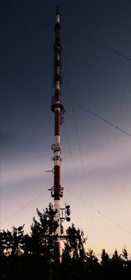
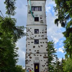
The Lichtenberg transmission mast is a steel broadcasting facility that rises 156 meters into the sky and features a distinctive cylindrical structure at its peak for UHF broadcasting antennas. The facility is equipped with an internal elevator providing maintenance access up to 80 meters and includes backup power systems to ensure uninterrupted broadcasting operations.
The facility began operations on November 17, 1960, marking the start of a new era for broadcasting capabilities in the Upper Austria region. This event signaled the technological progress that the community experienced during the post-war period.
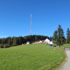
The transmission tower appears on the municipal coat of arms of Lichtenberg as a symbol of technological progress. The structure shapes the landscape profile and serves as a key landmark recognized by residents.
The mast is located in Lichtenberg and is visible as a distinctive structure from the outside, making it easy to spot from various parts of the area. Visitors should know that the facility is operational, so access to certain areas may be restricted.
The broadcasting signal reaches beyond Austrian borders into parts of Bavaria, providing stronger reception there than neighboring transmission stations. This cross-border reach makes the facility an important technical infrastructure for the larger region across state lines.
The community of curious travelers
AroundUs brings together thousands of curated places, local tips, and hidden gems, enriched daily by 60,000 contributors worldwide.