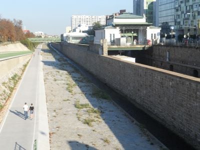
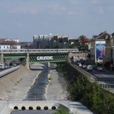
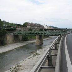
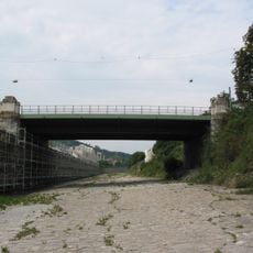
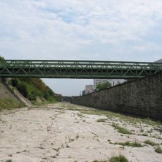
Bridges over the Wien River, Architectural bridge ensemble in Hadikgasse, Vienna, Austria.
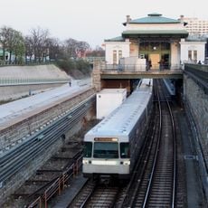
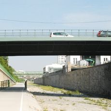
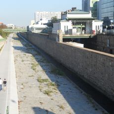
The bridges over the Wien connect different parts of Vienna and form a branching network of crossings. Each bridge has its own structure and size, with some serving vehicles and pedestrians while others handle specialized traffic.
These bridges emerged during Vienna's rapid expansion in the 19th century as modern steel structures. They replaced earlier wooden constructions that needed regular renewal and could not meet growing traffic demands.
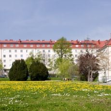
The bridges display different architectural styles from various periods and shape the character of the surrounding neighborhoods. You can see how the city developed over time and designed its connections between districts.
The bridges are accessible on foot or by transport and serve as natural orientation points across the city. It helps to explore them at different times of day to see how their use changes throughout.
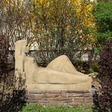
Many of these bridges are not just traffic routes but also carry artistic elements in their design. When you look closely at them, you discover details in their construction that show how engineers and architects combined functionality with beauty.
Location: Vienna
Address: Hadikgasse
GPS coordinates: 48.19293,16.27041
Latest update: December 12, 2025 07:54
Hugo-Breitner-Hof
492 m
Wohnhausanlage Hadikgasse 268-272
200 m
Wohnhausanlage Hadikgasse 288-294
196 m
Wohnhausanlage Deutschordenstraße 7-25
561 m
Ehem. Stadtbahn – Teilbereich der heutigen U4 in der KG Ober St. Veit
222 m
Oblatenkloster St. Paul
211 m
St. Veiter Brücke
267 m
Gartenbaudenkmal – Steinbassin
468 m
Ehem. Stadtbahn – Teilbereich der heutigen U4 in der KG Hacking
457 m
Statue of John of Nepomuk, Ober Sankt Veit
328 m
Gesamtanlage Wienflussregulierung und -verbauung (samt Brücken, Geländern und sonstigen baulichen Bestandteilen) – unter Ausnahme aller jener Bauteile und Zutaten deren Errichtungszeitpunkt in die Zeit nach 1918 fällt
0 m
Schule Amalienstraße, Vienna
404 m
Diverse Gartenbaudenkmale
558 m
Fachschule für wirtschaftliche Berufe
323 m
Wientalverbauung in der KG Oberbaumgarten
14 m
St. Veiter Brücke (KG Ober St. Veit)
272 m
Ober St. Veit, St. Vitus-Haus
546 m
Straßenbrücke, Preindlsteg über den Wienfluß und U4 (KG Oberbaumgarten)
561 m
Preindlsteg über den Wienfluß und U4 (KG Ober St. Veit)
561 m
Fußgängerbrücke, Zufferbrücke
404 m
Hackinger Mühle zum Deutschen Orden
414 m
Wohnhausanlage Hochsatzengasse 6
390 m
Wirtschaftsbauten
430 m
Franz-Glaserer-Hof
129 m
Gymnasium
520 m
Volksschule, Kindergarten
562 m
Straßenbrücke, St. Veiter Brücke (KG Oberbaumgarten)
269 m
Preindlsteg
561 mVisited this place? Tap the stars to rate it and share your experience / photos with the community! Try now! You can cancel it anytime.
Discover hidden gems everywhere you go!
From secret cafés to breathtaking viewpoints, skip the crowded tourist spots and find places that match your style. Our app makes it easy with voice search, smart filtering, route optimization, and insider tips from travelers worldwide. Download now for the complete mobile experience.
A unique approach to discovering new places❞
— Le Figaro
All the places worth exploring❞
— France Info
A tailor-made excursion in just a few clicks❞
— 20 Minutes