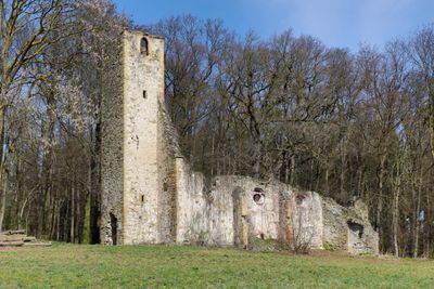
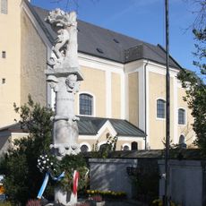
Church ruins of St. Cecilia, Medieval church ruins in Perersdorf, Austria.
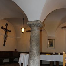
The Church ruins of St. Cecilia is a medieval building featuring a 30-meter standing tower and remnants of a nave that measured about 27 meters long and 8 meters wide. The southern section preserves an intact vaulted sacristy, while the remaining areas exist as stone walls.
The site was first recorded in 1280 and saw reconstruction after the 1683 invasion. Destruction by French forces in 1805 led to its gradual decline afterward.
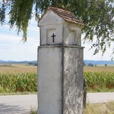
The place is named after Saint Cecilia, the patron saint of musicians, who was honored here in past times. Visitors can still sense the religious significance of the site through its standing walls and preserved structures.
The ruins sit on an elevated position along the road between Pyhra and Böheimkirchen and are easily visible from outside. The site is accessible, though visitors should be prepared for uneven ground and the exposed stone structure.
The sacristy on the southern side retained its vaulted ceiling and integrity while most other sections became open walls. This makes it a rare example of a preserved interior structure among church ruins.
Location: Pyhra
GPS coordinates: 48.18905,15.72527
Latest update: December 9, 2025 20:20
Peter am Anger, Außerkasten, Böheimkirchen
4.1 km
Pfarrkirche Pyhra
4.4 km
Filialkirche Lanzendorf (Böheimkirchen)
4.7 km
Pfarrkirche hl. Jakobus der Ältere, Böheimkirchen
2.9 km
Ortskapelle Mechters
1.1 km
Filialkirche hl. Nikolaus, Schildberg
3.6 km
Nischen-/Kapellenbildstock hl. Johannes Nepomuk
3 km
Wayside shrine and bell tower, Untergrafendorf
4.6 km
Flur-/Wegkapelle
2.7 km
Kapelle hll. Rosalia und Vitus, Weisching
3 km
Ortskapelle
1.1 km
Rathaus/Gemeindeamt, ehem. Musterschule
4.5 km
Brücke über den Stössingbach in Mitterfeld
4.7 km
2 Kanalbrücken (Nützling 1, 2), Einsteigturm 87
4.9 km
Pranger
4.4 km
Einsteigturm 90, II HQL, Kasten bei Böheimkirchen
5.1 km
Pfarrhof Pyhra
4.5 km
Kriegerdenkmal
2.9 km
Ehem. landwirtschaftliche Fachschule
4.8 km
Rathaus/Gemeindeamt
2.9 km
Bildstock L120
4.5 km
Schloss Neutenstein
4.5 km
Pfarrhof Böheimkirchen
2.9 km
Michelbachdüker
5 km
Reintalaquädukt
5.2 km
Bildstock, Pestsäule
4.6 km
Hauptschule
4.5 km
Hausberg Ödes Schloss
2.2 kmVisited this place? Tap the stars to rate it and share your experience / photos with the community! Try now! You can cancel it anytime.
Discover hidden gems everywhere you go!
From secret cafés to breathtaking viewpoints, skip the crowded tourist spots and find places that match your style. Our app makes it easy with voice search, smart filtering, route optimization, and insider tips from travelers worldwide. Download now for the complete mobile experience.
A unique approach to discovering new places❞
— Le Figaro
All the places worth exploring❞
— France Info
A tailor-made excursion in just a few clicks❞
— 20 Minutes