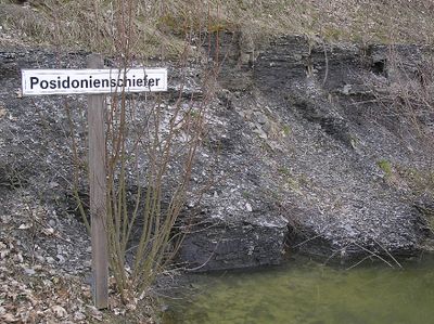
Posidonia Shale, Jurassic geological formation in Holzmaden, Germany
Posidonia Shale is a Jurassic rock formation in the Holzmaden area of southwestern Germany composed of black shale layers interspersed with bituminous limestone. These rocks formed roughly 183 million years ago in a tropical seabed and vary in thickness from 1 to 40 meters depending on the location.
The first fossils from these layers were recorded in 1598 by Johannes Bauhin, marking the beginning of centuries of paleontological study. Since then, the formation has become one of the most important sources of information about ancient marine reptiles and their world.
The formation holds deep significance for Holzmaden's identity, as fossils from these layers have drawn scientists and collectors for centuries, shaping how people understand ancient life. Today, these specimens remain central to local museums and research, reflecting the enduring fascination with what lies beneath the ground.
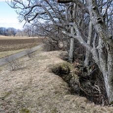
Fossils from the formation are best seen in museums like the Urweltmuseum Hauff rather than in active quarries, which may have restricted access. Visiting during warmer months allows for better conditions if you want to explore quarry areas on foot.
Fossils in this formation occasionally preserve soft tissues and internal organs of marine reptiles, a rarity in the fossil record that provides extraordinary insight into their anatomy. Some specimens of Stenopterygius contain unborn young, offering direct evidence of how these creatures reproduced millions of years ago.
The community of curious travelers
AroundUs brings together thousands of curated places, local tips, and hidden gems, enriched daily by 60,000 contributors worldwide.