Enable Location

We need your location to show you interesting places around you

Discover nearby places

Find interesting locations and hidden gems around you

Precise directions

Get accurate directions and distances to places

Your location is never shared with other users. It's only used when you tap the location button.

Osternig

Log in to your account

Start exploring — it's free

Trusted by 62,189 travelers worldwide

Continue with Google
Continue with Apple
or

We will send you a code to connect

By continuing, you accept our Terms and Conditions and our Privacy Policy

Check your inbox

We've sent a pincode in your inbox. Please enter the code below.

Osternig

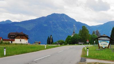
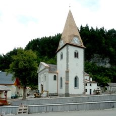
Osternig, Mountain summit in Sankt Stefan im Gailtal, Austria

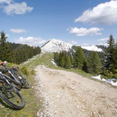
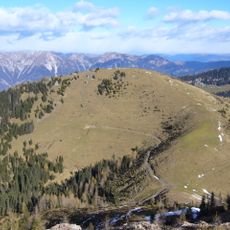
Osternig is a mountain peak reaching 2052 meters that marks the border between Austria's Carinthia and Italy's Friuli Venezia Giulia. The summit offers open views across the Carnic Alps and is surrounded by dense forest at lower elevations that gradually gives way to alpine meadows.

The mountain lay along ancient trade routes that connected medieval settlements on both sides of the Alps for centuries. These mountain passes facilitated the exchange of goods and cultural influences between northern and southern regions.

The summit serves as a meeting point where Austrian and Italian mountaineers gather and share their climbing traditions across the border. Visitors from both sides use this place to strengthen connections and experience the mountains as a shared space rather than a dividing line.

The hiking route is well marked and takes about four hours from Rifugio Nordio at 1406 meters, which serves as the main starting point. The trail passes through forest and then open alpine meadows, making sturdy hiking boots essential for the terrain.

In winter, the summit often displays completely different weather conditions on each side of the border, with one side snow-covered and the other receiving little snow. This happens because opposing air currents from the northwest and southeast collide at the peak.

The community of curious travelers

AroundUs brings together thousands of curated places, local tips, and hidden gems, enriched daily by 60,000 contributors worldwide.

Start exploring
Elevation above the sea
2,052 m
GPS coordinates
46.56593,13.49956
Latest update
December 14, 2025 20:03
« Osternig - Mountain summit in Sankt Stefan im Gailtal, Austria » is provided by Around Us (aroundus.com). Images and texts are derived from Wikimedia project under a Creative Commons license. You are allowed to copy, distribute, and modify copies of this page, under the conditions set by the license, as long as this note is clearly visible.

Discover hidden gems everywhere you go!

From secret cafés to breathtaking viewpoints, skip the crowded tourist spots and find places that match your style. Our app makes it easy with voice search, smart filtering, route optimization, and insider tips from travelers worldwide. Download now for the complete mobile experience.

Around Us App Screenshot

A unique approach to discovering new places

Le Figaro

All the places worth exploring

France Info

A tailor-made excursion in just a few clicks

20 Minutes

Around Us
Travel Guide & Maps
Download

Send to your phone

QR Code
1

Open the camera app on your mobile.

2

Point at the QR code with your camera. A notification will appear.

3

Tap the notification to open the link.