Wöllaner Nock, Mountain summit in Arriach, Austria
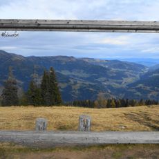
Wöllaner Nock is a mountain summit in the Gurktal Alps that rises to 2,145 meters and is reached by several marked hiking paths. The routes pass through varied landscapes with natural surfaces and offer different difficulty levels for hikers.
The name derives from the hamlet of Wöllan (Ober- and Unterwöllan) on the southern slope in the municipality of Arriach, documented in 1299 as "auf dem Welein"; it probably goes back to a Slavic personal name reconstructed as *Velenъ. The summit, at 2,145 m the highest point of Arriach, lies where the districts of Feldkirchen, Villach-Land and Spittal an der Drau meet on a saddle between the main peak and the Kaiserburg (2,055 m).
The name derives from Wöllan (Ober- and Unterwöllan) on the southern slope, first recorded in 1299 as "auf dem Welein" and probably going back to a Slavic personal name reconstructed as *Velenъ. The Salzsteigweg, an Austrian long-distance trail from the Böhmerwald to Arnoldstein, crosses the summit.
The main summit lies in the municipality of Arriach and is its highest point; the Salzsteigweg long-distance trail from the Böhmerwald to Arnoldstein runs over the top. The borders of the Feldkirchen, Villach-Land and Spittal an der Drau districts meet on the saddle between the main summit and the Kaiserburg (2,055 m) to the north.
The geographic centre of Carinthia lies on the mountain's southern slope, below the Buchskopf (1865 m) and above the Arriach hamlet of Laastadt. The long eastern ridge, dropping about 15 km to the Tiebel valley, carries the small ponds around the Dürrer Baum knoll (1771 m).
The community of curious travelers
AroundUs brings together thousands of curated places, local tips, and hidden gems, enriched daily by 94,302 contributors worldwide.