Enable Location

We need your location to show you interesting places around you

Discover nearby places

Find interesting locations and hidden gems around you

Precise directions

Get accurate directions and distances to places

Your location is never shared with other users. It's only used when you tap the location button.

Hochtausing

Log in to your account

Start exploring — it's free

Trusted by 61,334 travelers worldwide

Continue with Google
Continue with Apple
or

We will send you a code to connect

By continuing, you accept our Terms and Conditions and our Privacy Policy

Check your inbox

We've sent a pincode in your inbox. Please enter the code below.

Hochtausing

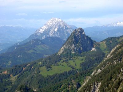
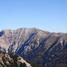
Hochtausing, Alpine summit in Totes Gebirge, Austria.

Description

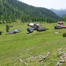
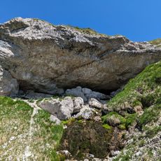
Hochtausing is a summit in the Totes Gebirge reaching approximately 1800 meters, with steep faces descending into deep forest on both sides. The mountain stands above rugged terrain marked by exposed rock bands and sits within alpine grasslands.

History

Mountain guides developed climbing routes on this peak during early explorations of the Totes Gebirge range in the Alpine region. The paths were established through systematic study of the steep terrain during mountaineering's expansion in the late 1800s.

Culture

Local climbers maintain the secured Toni-Steig route as a traditional path through the mountain, marked with metal pegs and handholds. The way it is used today reflects how mountaineers have adapted this terrain for safer passage.

Practical

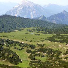
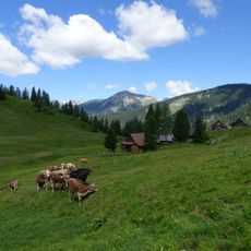
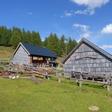
The ascent starts from Schönmoos parking and follows marked trails through woodlands up to the eastern climbing route near 1450 meters elevation. The climb works best during stable weather with proper hiking and climbing gear.

Did you know?

The eastern face contains technical climbing sections that demand skill in rock scrambling and require downclimbing near the summit. These challenging passages are not obvious until hikers reach the steeper terrain above the forest line.

Location
Location
Elevation above the sea
1,823 m
GPS coordinates
47.58444,14.15636
Latest update
December 14, 2025 20:04

AroundUs brings together thousands of curated places, local tips, and hidden gems, enriched daily by 60,000 contributors worldwide. Discover all places nearby (Wörschach).

« Hochtausing - Alpine summit in Totes Gebirge, Austria » is provided by Around Us (aroundus.com). Images and texts are derived from Wikimedia project under a Creative Commons license. You are allowed to copy, distribute, and modify copies of this page, under the conditions set by the license, as long as this note is clearly visible.

Discover hidden gems everywhere you go!

From secret cafés to breathtaking viewpoints, skip the crowded tourist spots and find places that match your style. Our app makes it easy with voice search, smart filtering, route optimization, and insider tips from travelers worldwide. Download now for the complete mobile experience.

Around Us App Screenshot

A unique approach to discovering new places

Le Figaro

All the places worth exploring

France Info

A tailor-made excursion in just a few clicks

20 Minutes

Around Us
Travel Guide & Maps
Download

Send to your phone

QR Code
1

Open the camera app on your mobile.

2

Point at the QR code with your camera. A notification will appear.

3

Tap the notification to open the link.