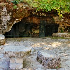
Kozija Pećina, Höhle in Bosnien und Herzegowina
Location: Republika Srpska
GPS coordinates: 42.81833,18.14944
Latest update: November 23, 2025 03:35
Vjetrenica
13.9 km
Vjetrenica
13.9 km
Храм Свете Недеље у Талежи
13.9 km
Église Saint-Mitre de Ravno
8.6 km
Čelo Gora
14.2 km
Veliki Vrh (tumoy sa bukid sa Krowasya, Dubrovačko-Neretvanska Županija, lat 42,73, long 18,03)
13.6 km
Ljeljanine Pećina
974 m
Ravni Vrh
11.7 km
Travnička Pećina
1.9 km
Čisti Vrh (tumoy sa bukid)
13.8 km
Vilar (langub)
9.4 km
Magudova Pećina
13 km
Gomila (tumoy sa bukid)
12 km
Golubinka (langub sa Bosnia ug Herzegovina, Republika Srpska, lat 42,76, long 18,13)
6.4 km
Krasovnica
7.2 km
Severna Pećina
12.1 km
Velika Pećina (langub sa Bosnia ug Herzegovina, Federation of Bosnia and Herzegovina, lat 42,77, long 18,01)
12.9 km
Vranja Pećina
6.4 km
Kikirina Pećina
3.6 km
Kurdeševa Pećina
12.6 km
Menada
12.9 km
Gradina (tumoy sa bukid sa Krowasya, Dubrovačko-Neretvanska Županija, lat 42,71, long 18,09)
13.3 km
Čijak (tumoy sa bukid)
13.5 km
Kalajisana Pećina
10.6 km
Puška (langub)
10.9 km
Bunina Pećina
10 km
Radoševa Pećina
12.1 km
Memorial
14 kmReviews
Visited this place? Tap the stars to rate it and share your experience / photos with the community! Try now! You can cancel it anytime.
Discover hidden gems everywhere you go!
From secret cafés to breathtaking viewpoints, skip the crowded tourist spots and find places that match your style. Our app makes it easy with voice search, smart filtering, route optimization, and insider tips from travelers worldwide. Download now for the complete mobile experience.

A unique approach to discovering new places❞
— Le Figaro
All the places worth exploring❞
— France Info
A tailor-made excursion in just a few clicks❞
— 20 Minutes