Chest opened
+${chestReward.xp} XP
Explorer
NOUVEAU ×${chestReward.collectible.quantity}
tapez pour fermer
Chest locked

Open chests in the app

Around Us is built for your phone — chests unlock when you walk, explore and capture nearby places.

Enable Location

We need your location to show you interesting places around you

Discover nearby places

Find interesting locations and hidden gems around you

Precise directions

Get accurate directions and distances to places

Your location is never shared with other users. It's only used when you tap the location button.

Log in to your account

Start exploring — it's free

Trusted by 72,957 travelers worldwide

Continue with Google
Continue with Apple
or

We will send you a code to connect

By continuing, you accept our Terms and Conditions and our Privacy Policy

Check your inbox

We've sent a pincode in your inbox. Please enter the code below.

Zaneski Potok
Discussion Reviews Photo
8.8k Popularity

Zaneski Potok, Mountain river in Federation of Bosnia and Herzegovina

Zaneski Potok is a mountain river in the Federation of Bosnia and Herzegovina that flows at approximately 600 meters elevation through forested and agricultural areas. The water moves steadily downslope, feeding into the broader network of streams and springs that sustains the region.

The river has maintained its natural course through centuries of regional changes, serving as a long-standing boundary marker between settlements. Human activity adapted to the waterway rather than altering its fundamental path.

Local communities along Zaneski Potok have developed traditions connected to the river, incorporating water management practices into their daily routines.

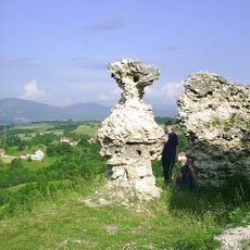
Visitors exploring the area can use the river as a natural reference point to navigate the mountain landscape and understand the terrain. Ground conditions vary seasonally, and sturdy footwear is always advisable when moving near the water or steeper banks.

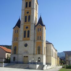
Zaneski Potok represents one of the numerous smaller waterways that form the intricate river system within the Federation of Bosnia and Herzegovina.

The community of curious travelers

AroundUs brings together thousands of curated places, local tips, and hidden gems, enriched daily by 60,000 contributors worldwide.

Start exploring
Elevation above the sea
593 m
GPS coordinates
44.00694,17.49556
Latest update
December 10, 2025 16:00
Around this place
Church of the Assumption of the Blessed Virgin Mary, Uskoplje
Bosnia and Herzegovina

Church of the Assumption of the Blessed Virgin Mary, Uskoplje

10.8 km
Saint Anthony of Padua church in Bugojno
Bosnia and Herzegovina

Saint Anthony of Padua church in Bugojno

6.6 km
Bosnia and Herzegovina

Nécropole de Maculje

15.5 km
Bosnia and Herzegovina

Vilinska Pećina

16.4 km
Clock Tower of Donji Vakuf
Bosnia and Herzegovina

Clock Tower of Donji Vakuf

17.1 km
Fortress of Prusac
Bosnia and Herzegovina

Fortress of Prusac

13.5 km
Bosnia and Herzegovina

Slap (busay)

15.7 km
Bosnia and Herzegovina

Orlovača (langub sa Bosnia ug Herzegovina, Federation of Bosnia and Herzegovina, lat 43,90, long 17,42)

13.1 km
Bosnia and Herzegovina

Villa Branka Mikulića

5.6 km
Bosnia and Herzegovina

Wayside cross

17.1 km
Bosnia and Herzegovina

Spomenik poginulim hrvatskim braniteljima

17.4 km
Bosnia and Herzegovina

Raspeti Krist

17.2 km
Bosnia and Herzegovina

Semešnica

18.9 km
Bosnia and Herzegovina

Titos Villa "Gorica"

5.6 km
Bosnia and Herzegovina

Ždrimački vodopad

15.7 km
Bosnia and Herzegovina

Divin dom

19.9 km
Bosnia and Herzegovina

Ranokršćanska bazilika

15.3 km
Bosnia and Herzegovina

11930

16.6 km
Bosnia and Herzegovina

Wayside cross

9 km
Bosnia and Herzegovina

Memorial

13.5 km
Bosnia and Herzegovina

Spomenik svim poginulima

3.1 km
Bosnia and Herzegovina

Zavjetni križ

1.8 km
Bosnia and Herzegovina

Spomen i križ za poginule u II. svjetskom ratu

15.6 km
Bosnia and Herzegovina

Spomenik poginulim u Domovinskom ratu

5.7 km
Bosnia and Herzegovina

Monument

17.1 km
Bosnia and Herzegovina

Monument

17.1 km
Bosnia and Herzegovina

Monument

6.5 km
Bosnia and Herzegovina

Waterfall

15.7 km
Show the full map
Reviews
Share your experience

No review yet

Discussions
Start a discussion...

No discussion yet

« Zaneski Potok - Mountain river in Federation of Bosnia and Herzegovina » is provided by Around Us (aroundus.com). Images and texts are derived from Wikimedia project under a Creative Commons license. You are allowed to copy, distribute, and modify copies of this page, under the conditions set by the license, as long as this note is clearly visible.

Discover hidden gems everywhere you go!

From secret cafés to breathtaking viewpoints, skip the crowded tourist spots and find places that match your style. Our app makes it easy with voice search, smart filtering, route optimization, and insider tips from travelers worldwide. Download now for the complete mobile experience.

Around Us App Screenshot

A unique approach to discovering new places

Le Figaro

All the places worth exploring

France Info

A tailor-made excursion in just a few clicks

20 Minutes

Around Us
Travel Guide & Maps
Download

Send to your phone

QR Code
1

Open the camera app on your mobile.

2

Point at the QR code with your camera. A notification will appear.

3

Tap the notification to open the link.