Enable Location

We need your location to show you interesting places around you

Discover nearby places

Find interesting locations and hidden gems around you

Precise directions

Get accurate directions and distances to places

Your location is never shared with other users. It's only used when you tap the location button.

Panchagarh District

Log in to your account

Start exploring — it's free

Trusted by 63,011 travelers worldwide

Continue with Google
Continue with Apple
or

We will send you a code to connect

By continuing, you accept our Terms and Conditions and our Privacy Policy

Check your inbox

We've sent a pincode in your inbox. Please enter the code below.

Discussion Reviews 2 Photos
25.5k Popularity

Panchagarh District, Administrative district in northern Rangpur Division, Bangladesh

Panchagarh is an administrative district in Bangladesh's northernmost region, bordered by India on three sides. Several rivers flow through the territory, shaping the local landscape.

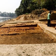
The district became an independent administrative unit in 1984, with roots tracing back to British colonial times. The area was previously divided among larger administrative regions before gaining its current status.

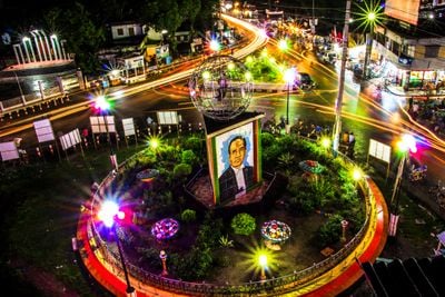
Local festivals and community celebrations shape how people here mark their calendar and spend time together. These gatherings reflect the daily rhythms and values of the residents who live in the district.

The region connects to major cities through regular bus services and has a direct train line to Dhaka since 2018. Travel is easiest outside the rainy season when roads and pathways are in better condition.

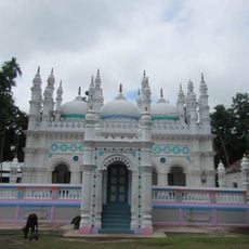
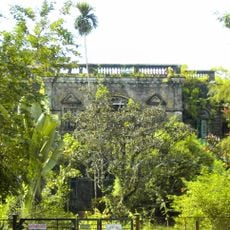
The territory is known for five historical fortifications called garhs that define its landscape. These structures are remnants of earlier periods and continue to shape how the region appears today.

The community of curious travelers

AroundUs brings together thousands of curated places, local tips, and hidden gems, enriched daily by 60,000 contributors worldwide.

Start exploring
Location
Capital city
Panchagarh
Shares border with
Thakurgaon District, Dinajpur District, Nilphamari District
GPS coordinates
26.25000,88.50000
Latest update
December 14, 2025 07:03
Reviews
Share your experience

No review yet

Discussions
Start a discussion...

No discussion yet

Administrative divisions
« Panchagarh District - Administrative district in northern Rangpur Division, Bangladesh » is provided by Around Us (aroundus.com). Images and texts are derived from Wikimedia project under a Creative Commons license. You are allowed to copy, distribute, and modify copies of this page, under the conditions set by the license, as long as this note is clearly visible.

Discover hidden gems everywhere you go!

From secret cafés to breathtaking viewpoints, skip the crowded tourist spots and find places that match your style. Our app makes it easy with voice search, smart filtering, route optimization, and insider tips from travelers worldwide. Download now for the complete mobile experience.

Around Us App Screenshot

A unique approach to discovering new places

Le Figaro

All the places worth exploring

France Info

A tailor-made excursion in just a few clicks

20 Minutes

Around Us
Travel Guide & Maps
Download

Send to your phone

QR Code
1

Open the camera app on your mobile.

2

Point at the QR code with your camera. A notification will appear.

3

Tap the notification to open the link.