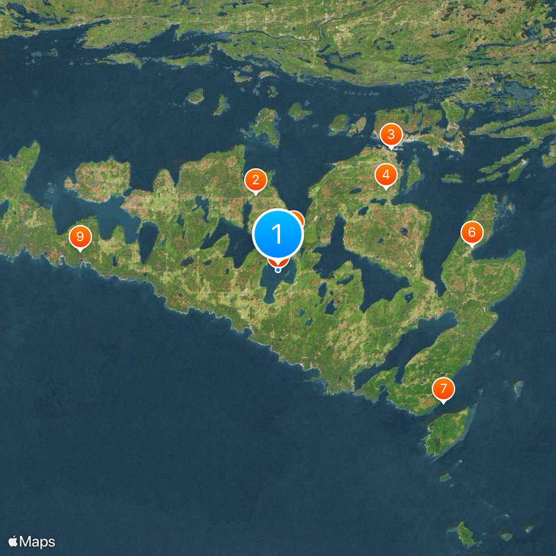
Manitoulin Island, Freshwater island in Lake Huron, Canada.
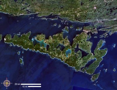
Manitoulin Island is a freshwater island in Lake Huron in Ontario, Canada, measuring around 2,766 square kilometers (about 1,068 square miles). The island holds more than one hundred smaller lakes within its landmass and is edged along the north by limestone cliffs rising above the shoreline.
Archaeological finds on the island show traces of human settlement going back roughly ten thousand years before the common era. European explorers reached the island in the 1600s and brought trade and missionary activity, before the area later became part of Canada.
The Anishinaabe have lived on this land for centuries and call the island Mnidoo Mnis, meaning
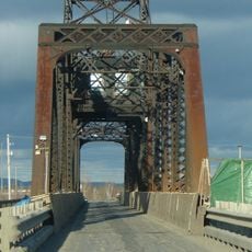
Travelers reach the island using the Little Current Swing Bridge, which operates year-round, or by taking the Chi-Cheemaun car ferry from Tobermory between May and October. Roads across the island suit driving, cycling, and walking, though some areas may be harder to access depending on the season.
Nested within the island is Lake Manitou, the largest lake sitting on a freshwater island anywhere in the world. This body of water covers a considerable area and forms a rare geographic feature within the freshwater realm.
Location: Ontario
Elevation above the sea: 352 m
GPS coordinates: 45.76667,-82.20000
Latest update: December 4, 2025 19:03
Bruce Peninsula National Park
74.4 km
Killarney Provincial Park
75.8 km
Fathom Five National Marine Park
66.8 km
Little Current Swing Bridge
32.5 km
Thunder Bay National Marine Sanctuary
118.3 km
La Cloche Provincial Park
40 km
SS Norisle
0 m
Old Presque Isle Light
110.3 km
SS Russia (1872)
107.9 km
Cove Island Light
60.9 km
New Presque Isle Light
110.6 km
Rockport State Recreation Area
112.6 km
Chutes Provincial Park
51.6 km
Killarney Provincial Park Observatory
67.8 km
Thompson's Harbor State Park
116.7 km
Holy Cross Church, Wikwemikong
38.3 km
Thunder Bay Island Light
112.4 km
Big Tub Lighthouse
70 km
Anishinabe Spiritual Centre
62.9 km
Middle Island Light
108.3 km
Cabot Head Provincial Nature Reserve
85.3 km
Ojibwe Cultural Foundation
7.3 km
Fire Tower Mountain
77.4 km
Killarney East Lighthouse
59.5 km
Mount Dufour
77.3 km
Cabot Head Lighthouse
91.6 km
Maxton Plains
118.5 km
Flowerpot Island Lighthouse
68.6 kmReviews
Visited this place? Tap the stars to rate it and share your experience / photos with the community! Try now! You can cancel it anytime.
Discover hidden gems everywhere you go!
From secret cafés to breathtaking viewpoints, skip the crowded tourist spots and find places that match your style. Our app makes it easy with voice search, smart filtering, route optimization, and insider tips from travelers worldwide. Download now for the complete mobile experience.
A unique approach to discovering new places❞
— Le Figaro
All the places worth exploring❞
— France Info
A tailor-made excursion in just a few clicks❞
— 20 Minutes