Appalaches Regional Park, Regional park in Montmagny, Canada.
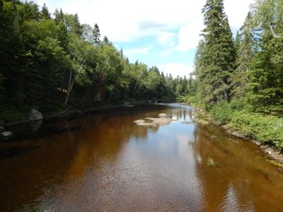
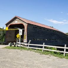
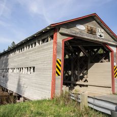
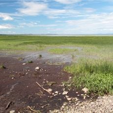
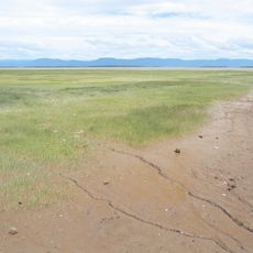
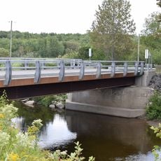
Appalaches Regional Park sits in Quebec's Chaudière-Appalaches region and encompasses dense forests, several lakes, and mountain ridges. The area is crossed by roughly 30 footbridges that link its extensive trail network.
The park received official recognition from Quebec's Commission de toponymie in 2004, confirming its status as a protected natural area. This designation formalized the preservation of a landscape that indigenous peoples had inhabited and shaped for centuries.
The name references the Appalachian mountain chain and honors the Wabanaki Confederacy peoples who lived here before European settlers arrived. Today, visitors experience this connection to the land through trails that wind respectfully through forests and around water features.
The park offers roughly 140 kilometers of trails suited for hiking, cycling, and winter sports at various difficulty levels. Accommodations range from basic camping spots to fully equipped cabins depending on your preference.
Grande Coulée Mountain stands at 853 meters and marks the highest point in the park, offering sweeping views across the diverse landscape of forests and waterways below. This vantage point reveals the park's full geographic variety in a single panoramic view.
Location: Montmagny
Website: http://parcappalaches.com
GPS coordinates: 46.74305,-70.10278
Latest update: December 14, 2025 20:31
Vincelotte Windmill
44.1 km
Étienne-Paschal Taché House
43.7 km
Pont du Sault
25.1 km
Pont des Défricheurs
3.5 km
Cap-Saint-Ignace Migratory Bird Sanctuary
42.6 km
Montmagny Migratory Bird Sanctuary
43.3 km
Église Notre-Dame-Auxiliatrice de Notre-Dame-Auxiliatrice-de-Buckland
36.5 km
Cemetery of Saint-Pierre-de-la-Rivière-du-Sud
44.3 km
Église de Saint-Damien-de-Buckland
44.3 km
Église Sainte-Apolline de Sainte-Apolline-de-Patton
10.1 km
Noyau institutionnel de Cap-Saint-Ignace
42.4 km
Church Saint-Pierre-du-Sud
44.3 km
École-chapelle de Bras-d'Apic
24.2 km
Église Saint-Cajetan
37.1 km
Ancien magasin général Henri-Louis-Poulin
29 km
Church of St Ignatius
42.4 km
Église Notre-Dame-des-Prairies
43.7 km
Sanctuaire de la Vierge-de-Lourdes
36.8 km
Ancien presbytère de Saint-Damien-de-Buckland
44.3 km
Pont de la Rivière-de-la-Fourche-Ouest
36.1 km
Manoir et four à pain Couillard
43.3 km
Ancienne école normale de Saint-Damien-de-Buckland
44.4 km
Calvaire du Rang-Ville-Marie
37.4 km
Maison du Docteur-Alphée-Poirier
44.5 km
Maison généralice des Sœurs de Notre-Dame du Perpétuel Secours
44.5 km
Manoir Gamache
42.3 km
Maison Tanguay
36.7 km
Église Sainte-Sabine
33.8 kmVisited this place? Tap the stars to rate it and share your experience / photos with the community! Try now! You can cancel it anytime.
Discover hidden gems everywhere you go!
From secret cafés to breathtaking viewpoints, skip the crowded tourist spots and find places that match your style. Our app makes it easy with voice search, smart filtering, route optimization, and insider tips from travelers worldwide. Download now for the complete mobile experience.
A unique approach to discovering new places❞
— Le Figaro
All the places worth exploring❞
— France Info
A tailor-made excursion in just a few clicks❞
— 20 Minutes