The Cabox, Mountain summit in Newfoundland and Labrador, Canada.
The Cabox is the highest peak on the island of Newfoundland, rising to 812 meters above sea level. The summit crowns the central ridge of the Lewis Hills and commands broad views across the landscape from its exposed rocky top.
The Cabox was formed in the Precambrian, when the supercontinent Rodinia broke apart about 570 million years ago, a process driven by plate tectonics. The Lewis Hills, whose central peak it is, belong to the Long Range Mountains, a subrange of the Appalachian Mountains.
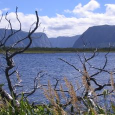
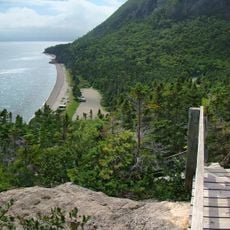
The Cabox is the central peak of the Lewis Hills, a ridge in the Long Range Mountains, itself part of the Appalachian chain that runs through western Newfoundland. The mountain lies close to the coast, roughly 30 km west of Corner Brook and near Stephenville, so the summit looks out over the Gulf of St. Lawrence.
The Cabox lies near the coast west of Corner Brook, about 30 km from the city, and is reached by hiking across the Lewis Hills; no road runs to the summit. Plan for wet, windy weather at any time of year and carry layers, food and water for the full day out.
The Cabox took its shape in the Precambrian, when plate tectonics broke up the supercontinent Rodinia about 570 million years ago. The Lewis Hills are part of the Long Range Mountains, a subrange of the Appalachians.
The community of curious travelers
AroundUs brings together thousands of curated places, local tips, and hidden gems, enriched daily by 94,051 contributors worldwide.