Rice Lake, Lake in Peterborough County, Canada
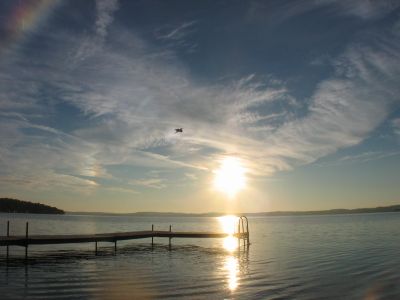
Rice Lake stretches about 28 kilometers in length with a maximum width of roughly 5 kilometers and forms part of the Trent-Severn Waterway system in Ontario. The water lies between the villages of Bewdley on the west and Hastings on the east, lined with public boat launches and camping areas.
The Mississauga Indigenous people called this water Pemadashdakota, meaning lake of the burning plains, before European settlement led to changes in water levels. This naming shift marked a turning point in how the lake and its surroundings developed.
The lake draws anglers year-round who gather to fish for walleye, bass, and muskellunge in its waters. Fishing traditions remain central to how locals and visitors use and value this place.
The lake has several public boat launches and camping areas along its shoreline that are easily accessible to visitors. The best time to visit depends on your interests, whether you want to fish, boat, or simply spend time outdoors.
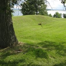
Several islands in the lake are actually partially submerged drumlins that belong to a larger drumlin field in the northwest section. These geological formations were created during the last ice age and give the lake its distinctive character.
The community of curious travelers
AroundUs brings together thousands of curated places, local tips, and hidden gems, enriched daily by 60,000 contributors worldwide.